
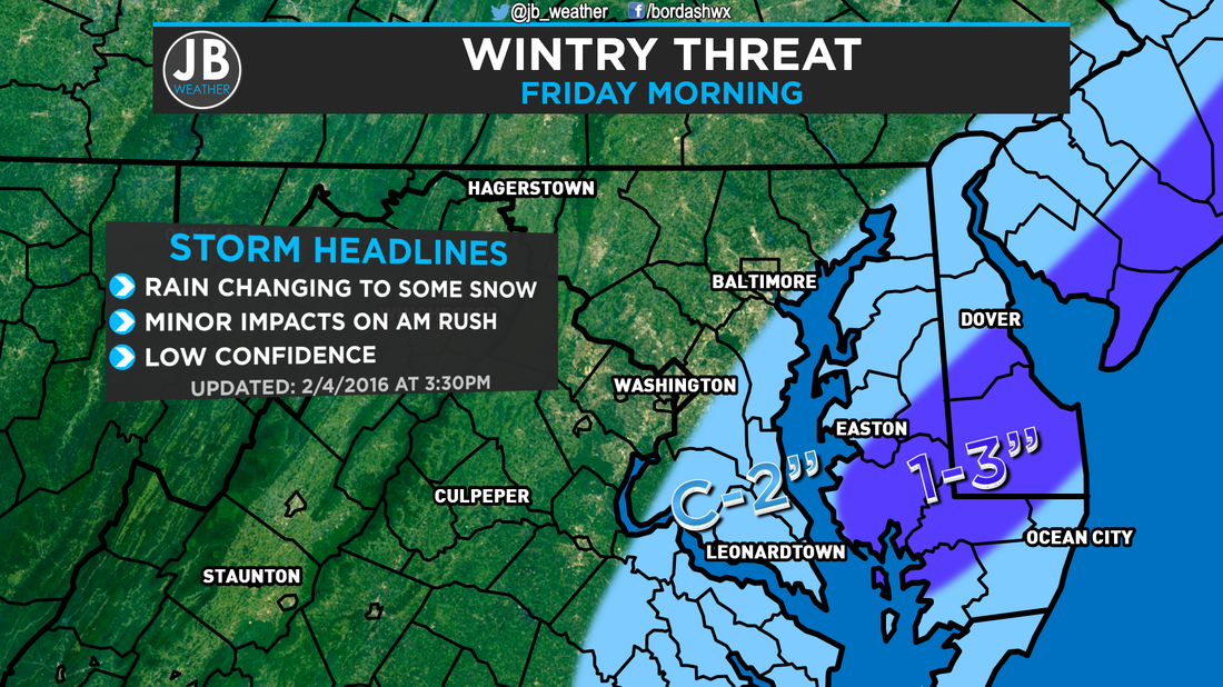
 The C-2 means a Coating to 2". I just ran out of room for the whole word. The forecast for tonight and tomorrow morning is not an easy one at all. The setup we have is marginal at best for accumulating snow, but the question is if the odds will work in our favor. I've seen setups similar to this before, and each time they it has been a tricky forecast. There is the potential for some good snows, but the bust potential is high. For a quick overview, scroll down to the "The Bottom Line" paragraph. The Setup we have going into tonight is marginal. We have the cold front that moved through yesterday sitting just off the coastline, with moisture streaming along it from the Gulf of Mexico. A weak area of low pressure will form along it, and run up the coast. The biggest question with this forecast is how close to the coast does it come? It's proximity to the coast will affect not only the amount of precipitation that gets thrown back to the coast, but how cold we are able to get. We have two scenarios for this storm. In Scenario 1 the storm is further out to sea, which would allow temperatures to fall between 30-34 with little to no precipitation. Our second scenario is that the storm moves closer to the coast which wouldn't allow temps to fall as low, only between 32 and 36, but we'd see more precip that could be heavy and may be able to overcome the temps. The "bust" potential comes in play more so with the second scenario. If the precip is not heavy enough, it will not be able to overcome the temps, and would be mainly rain. Today our weather models were showing a solution more like the second scenario, and based off Radar and Satellite today, I agree. Now the question is: will the precip be able to overcome the marginal temps and switch over to snow? My thinking is that it may take a while at first, but we will eventually switch over to snow. My biggest issue that I see with accumulating snow is that we have been warm the past few days, thus the ground temps are warm and road temps are even warmer. I expect any snow that falls to accumulate on grassy/shaded areas, on car tops, and maybe on your deck. If the snow falls heavy enough, there might some areas of slush on the roads. However, the bust potential would be that we are looking at no accumulation. 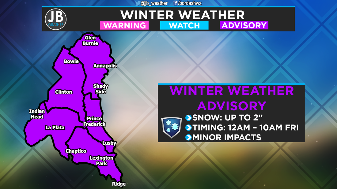 As you can see above, the National Weather Service has gone ahead and issued a Winter Weather Advisory for Southern Maryland. The further south and east you head, higher the chance of accumulating snow. The Impacts from this storm will not be high. The reason why this could be somewhat troublesome is the timing. Rain would transition over from snow between midnight and 3am, and any snow would be done by about 8 or 9am. There would be some impacts on the morning commute. How will this affect schools? If things unfold the way my forecast says, I could see delays for Calvert and St. Mary's. If the system moves further east, I could see delays for the other counties too. If any snow lasts longer, there may be some closings. But remember, the bust potential, in which we see just rain, would mean on time openings, hence why these numbers are low. 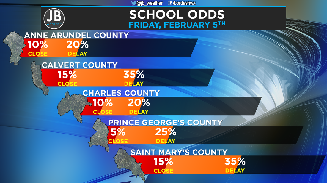  The Bottom Line is that snow is possible tomorrow morning. Temperatures will only be marginal for snow to fall and accumulate, so there is a high bust potential. It's for that reason that is a low confidence forecast. The further south and east you live, higher the chance for snow. Southern St. Mary's may end up with the highest totals for our region. There could be minor impacts tomorrow for the AM Rush. School delays are possible in Calvert & St. Mary's. I will start continuous coverage tomorrow morning at 4am to cover any delays & impacts to your morning commute. Stay with JB Weather for the latest on SoMD weather.
Lead Forecaster -John Bordash
0 Comments
Leave a Reply. |
Archives
August 2020
Categories
All
|
 RSS Feed
