
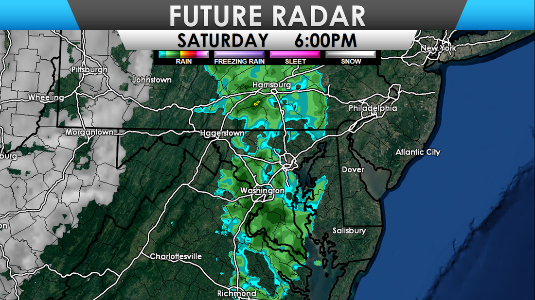
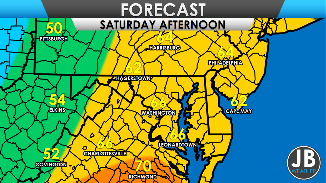
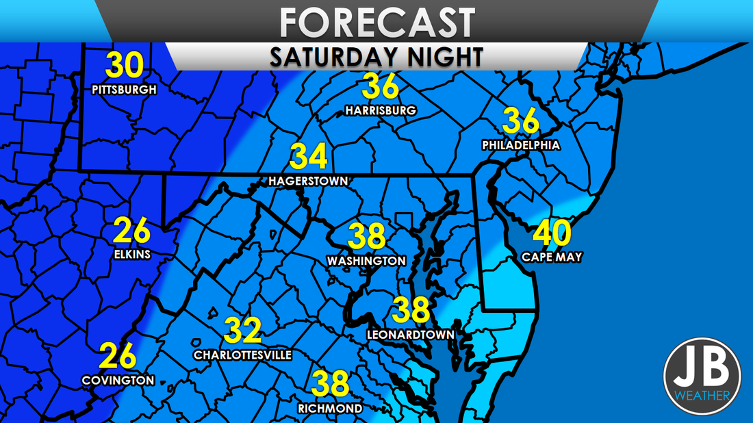
 A strong cold front will move across the Mid-Atlantic Saturday evening, bringing gusty northeast winds and cooler temperatures. Lows tonight get between 28 and 34 for most, with 10s and 20s for the mountains. A few showers will move through the region, with the cold front, this evening. Areas west of I-81 can expect showers between 1-3pm, between 3-5pm for areas between I-81 and I-95, and after 5pm for areas east of I-95. Ahead of the front, temperatures get between 63-70 degrees for most of the region. After the front moves through, temperatures will quickly fall off. Shown below are the expected temperatures at 8pm. 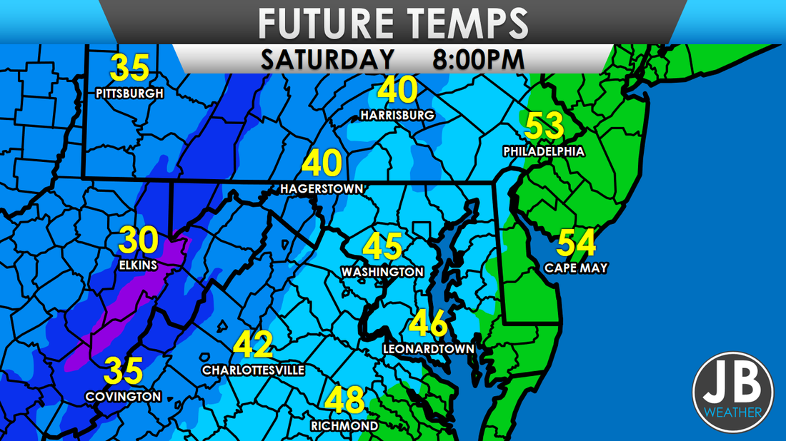 Additionally, behind the front, snow showers are expected in the mountains, and higher elevations. Winter Weather Advisories are in effect for these locations. I am not expecting any snow for any locations not in, or near, the mountains of MD, WV, and PA. Below is my snowfall forecast map. 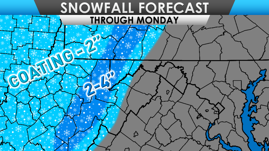 As mentioned before, strong winds will also move into the area, tonight through Sunday. A Wind Advisory is in effect for a large portion of the Mid-Atlantic. Winds could be sustained between 20 and 30mph with gusts up to 50mph. Strong winds may blow down limbs, trees, and some power lines. 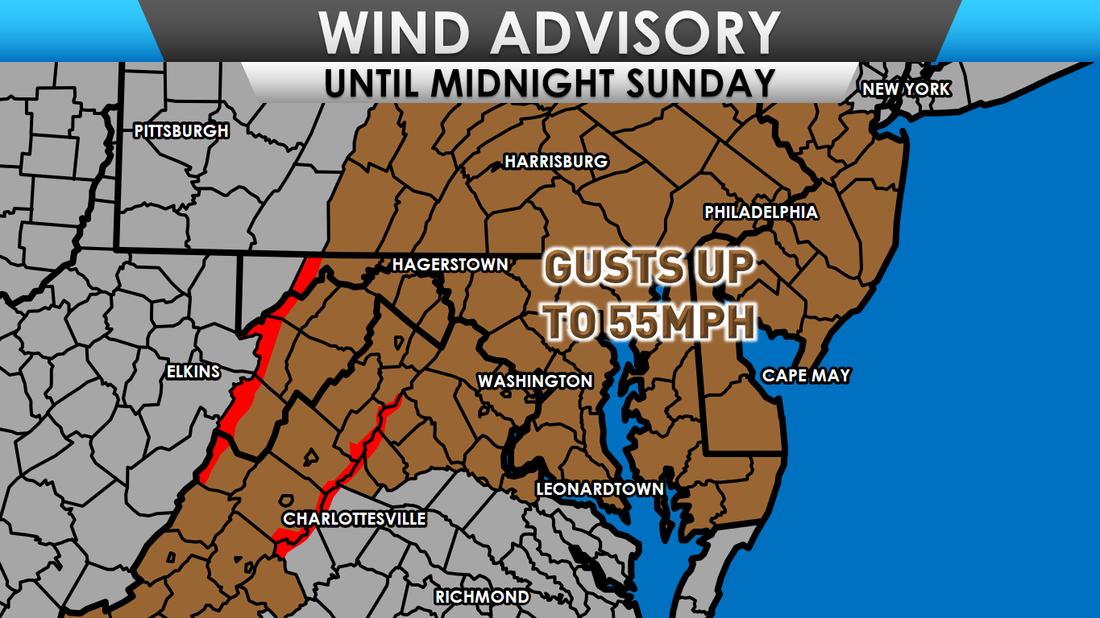
0 Comments
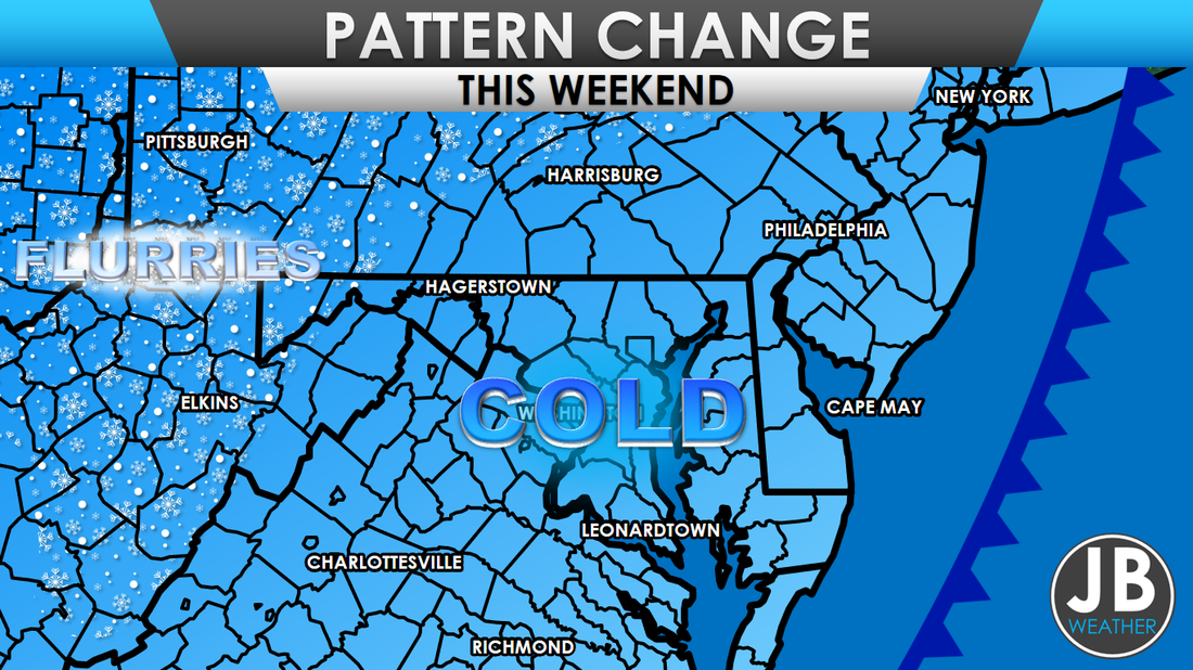 A cold front will work through the Mid-Atlantic Saturday night, ushering in the coldest air of the season yet. Flurries possible in the higher elevations. After a rather warm start to the season, November is about to show its true colors here in the Mid-Atlantic. A cold front will move across the region on Saturday, bringing gusty northwest winds and cooler temperatures. Some rain showers are possible Saturday evening throughout the region. Temperatures will peak in the 60s and lower 70s across the region on Saturday, ahead of the cold front. Once the front moves through, colder air will rush into region through the overnight hours. Low temperatures will bottom out in the 30s and 40s.
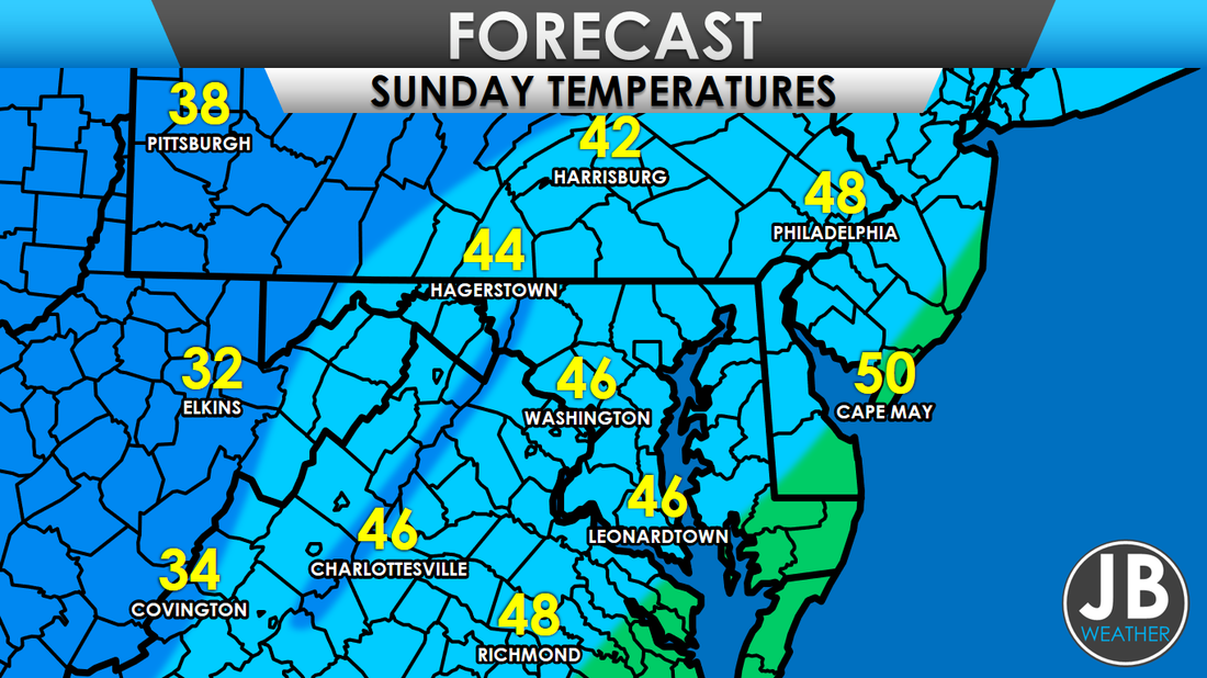
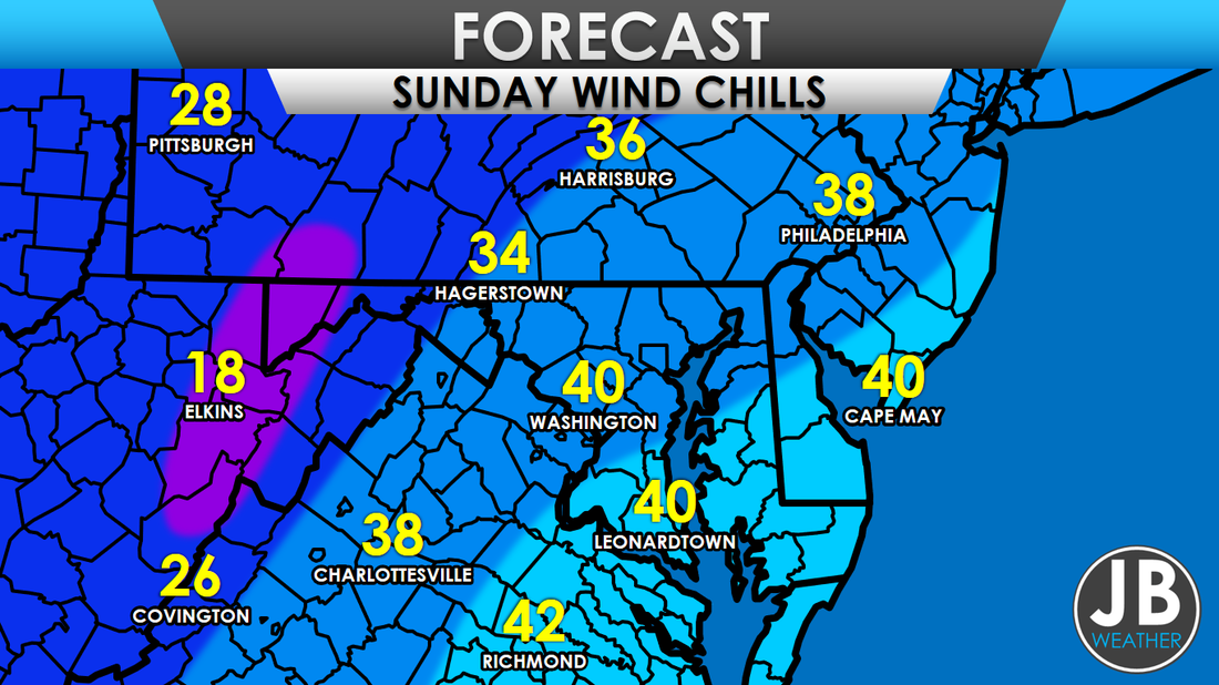
The cooler air will plunge high temperatures on Sunday into the 40s and 30s. These cold temperatures will be accompanied with gusty northwest winds that could get between 20-30mph. Those winds will make it feel 5-15 degrees colder than it actually is (wind chills).
The strong northwest winds, out of Canada, will also help to generate lake-effect snows for western areas of Pennsylvania and New York. As much as 4-8" of snow will be possible near Erie, PA. Those lake-effect snow bands will likely reach the Appalachian Mountains in PA, western MD, and WV, with an inch or two possible. Some random flurries may try to make their way down into southern PA, northern MD, and northern VA on Sunday. However, I am not expecting any accumulation at this time.
This cold front will help to set the tone for the end of the month. It looks like we are heading into a below average time frame, in regards to temperatures, to end the month. Right now, I do not see any substantial threats from winter weather for the Mid-Atlantic, outside of the Mountains, for the next two weeks. However, I am tracking the potential for a storm around the time of Thanksgiving, that looks to give the Mid-Atlantic some rain. Stay with JB Weather for the latest information. -John A. Bordash
NATIONAL FORECAST
MID ATLANTIC FORECAST
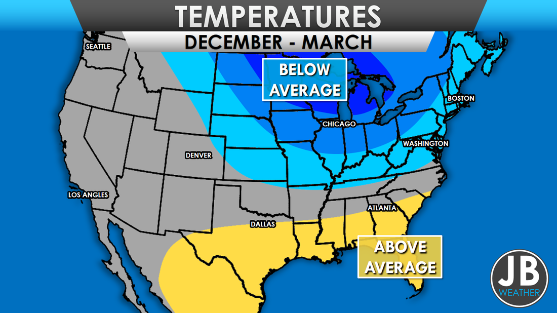
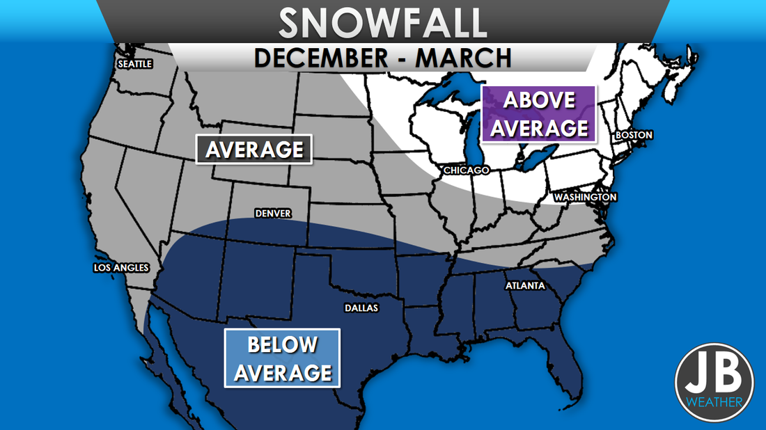
 TEMPERATURES With our Weak La Nina, the warm Alaskan waters, and increased Siberian snow cover factored into our forecast, I expect that this Winter season will be colder than average. I am anticipating for December and January to be predominately cold, quite the turnaround from last winter. February will likely feature warmer temperatures, part of a mid-winter thaw. However, temperatures likely return to the below-normal column in March. Once again, it looks like Spring could take a while to get its act together, after a tease in February  SNOWFALL AND ICE THREAT This winter will likely bring average to slightly above average snowfall across the region. I am expecting snowfall to be closer to average, the further south you go, and for coastal areas. Areas north of the Mason Dixon line should see above average snow. December and January should feature multiple, smaller storms that will mainly give northern areas snow, albeit light amounts. There may be one or two moderate snowfalls somewhere within the first two months of winter. The snow should take a break in February, and that would be when we have our increased threat of ice from freezing rain and sleet events. Some additional snow could be possible in March. I am expecting that any snow during the second half winter to favor southern areas. Below is a map of expected snowfall totals this winter, and a chart that pinpoints specific areas. 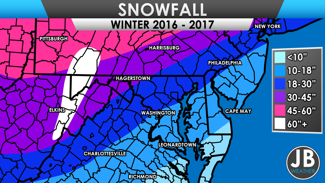 PINPOINT SNOWFALL FORECAST
IN CONCLUSIONOverall, it looks like we have a cold winter on the way for our area. December and January look like our coldest months, for this winter. We should see well near average snowfall this winter, with above average snowfall more likely the further north you head. I am not expecting any blizzards this winter. Instead of a couple of big events this winter, it looks like we should see multiple, smaller events. For my Southern Maryland followers, I am expecting 4-6 snow days this year for the school systems.
Stay tuned to JB Weather through the winter season for the latest Mid-Atlantic winter weather information! -John A. Bordash 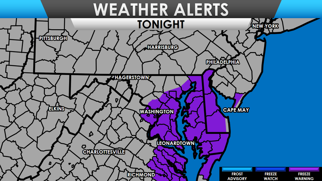 Freeze Warnings, for tonight, posted where the growing season is still active. Temperatures are expected to fall near freezing overnight Saturday, into Sunday. A freeze is likely, with the growing season likely coming to an end for the warned areas. 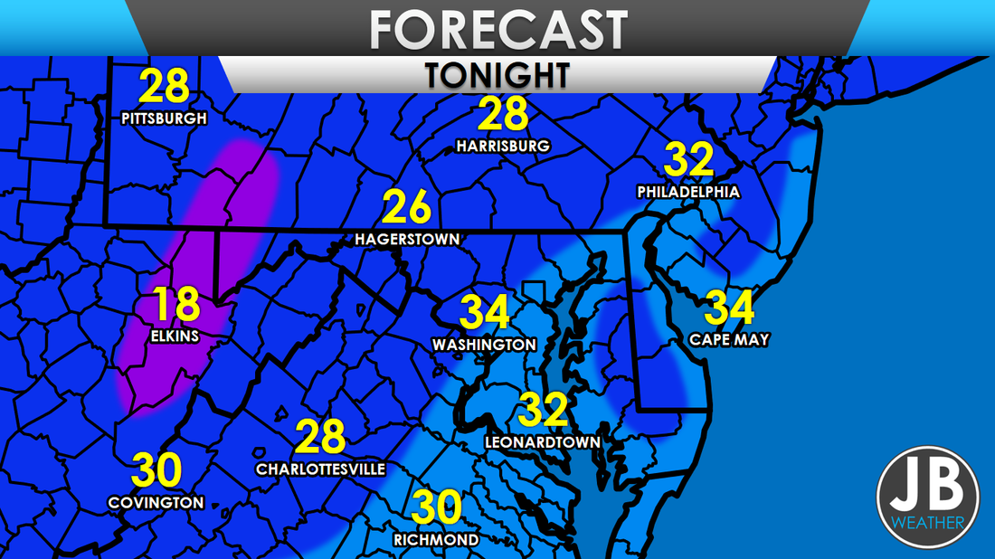 Frost will be abundant as temperatures drop near, or below, 32 degrees for coastal areas, with 20s further inland. Much of the freeze will occur between 6 and 8 am Sunday. For all intensive purposes, this freeze mark the end of this year's growing season.
 Lows on Sunday Morning The weather looks to remain quiet for the next 7-10 days, as not weather systems seem to threaten the Mid-Atlantic. The only story to report on will be temperatures, which look to take a temporary nose dive this weekend. Highs will be in the mid/upper 40s for areas NW of I-95, and lower 50s SE of I-95 on Saturday. This cool down will be very evident Sunday morning when temps dip down to the lowest point so far this season. For coastal areas that have yet to have their first frost or freeze, that likely ends this weekend. After the cool down this weekend, temperatures will rebound nicely into next week. We should stay dry next week, and temperatures look to be above average as well. I am still anticipating a pattern change, to more sustained cool weather, around Thanksgiving
-John A. Bordash |
Archives
August 2020
Categories
All
|


 RSS Feed
