
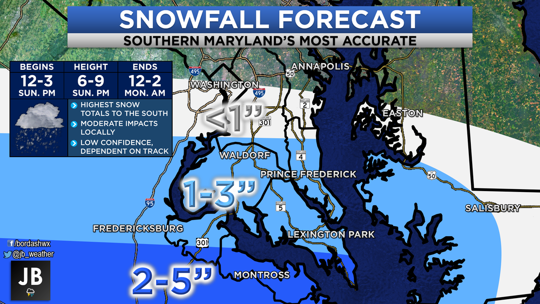
 My Latest Call on Snowfall Accumulation in Southern MD. Next Chance of Accumulating Snow: Sunday Afternoon Probability of Accumulating Snow: 60% A storm system is currently in the process of developing along the Gulf Coast. With cold air set in over the Mid-Atlantic, this storm looks to produce a large area of snow as it moves northward. It originally looked like storm would be forced to take a very southern track. That southern track would only bring areas in the Carolina's snow. That no longer appears to be the case. It now looks like the storm will be allowed to come a tick further north, putting Southern Maryland in play for accumulating snow. Shown below is the look of the storm this afternoon. 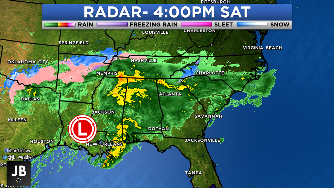 Even with a track further to the north, areas in the Carolina's and in Southwest Virginia still look to be in the bullseye. This is where Winter Storm WARNINGS are up. Snow up to 12" and accumulating ice will all be possible in the pink areas. Shown below are the winter weather alerts as of 4:30p Saturday. 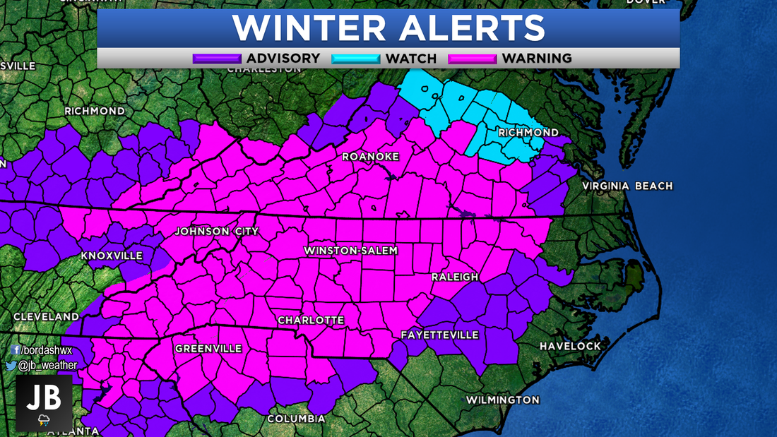 The local forecast is one of low confidence. Not only is the storm track in question, but we also need to take how dry the air will be into consideration. Radar might start to show snow as early as noon, but it may not start falling until 2-3pm because the air will be so dry. As the storm moves off shore, it will start to strengthen. With the storm strengthening, more moderate snows will be possible just after sunset, especially for southern areas. Snow should cut off overnight, between 12-2am Monday. Shown below is Futurecast stopped at 6pm. It shows bright white in Southern MD, which would be indicative of moderate snows. 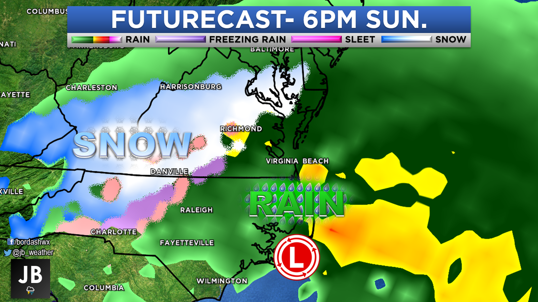 With the recent cold temperatures, snow will likely stick to all surfaces. Afternoon temps likely get around freezing, which will allow for the snow to be more of a wet snow, opposed to dry and fluffy. All in all, this will be a moderate impact storm, especially for southern areas. Shown below are the expected impacts for Sunday afternoon. It is too early to say how this storm will effect Monday. School Odds will be out tomorrow evening. 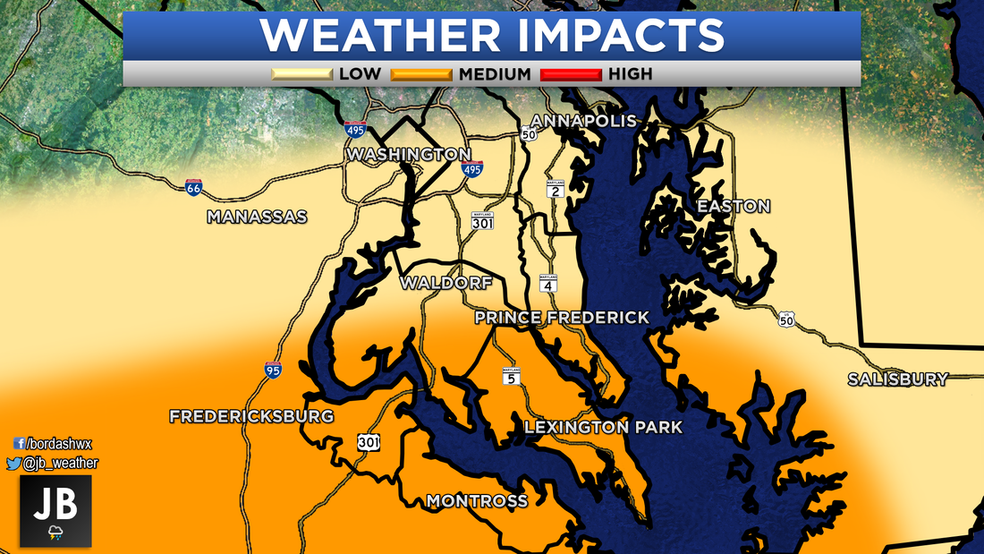 Trends today favor Southern Maryland snow lovers. It looks like this storm will indeed be allowed to come far enough north to bring accumulating snow into our region. Areas south of Route 231 have the best chance of accumulating snow, and will see the highest impacts. There is still a lot of uncertainty with this forecast. It is possible that storm comes even further north, and puts higher totals into our region. It is also possible that Southern Maryland misses out with a storm track that ends up going further south or that the air is too dry. I will be posting my final call tomorrow morning. Stay tuned to JB Weather for the latest updates.
Lead Forecaster -John A. Bordash
0 Comments
|
Archives
August 2020
Categories
All
|
 RSS Feed
