
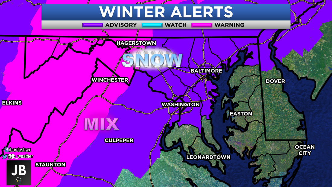
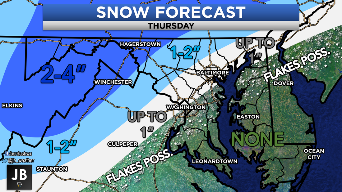
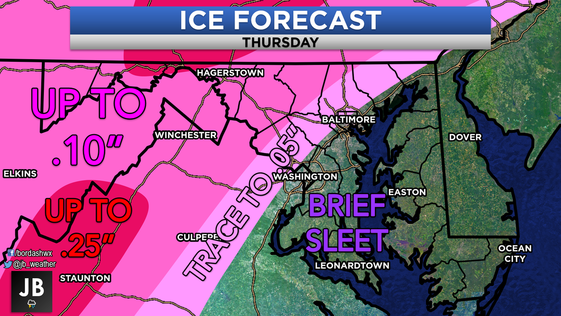
First Chance of Accumulating Snow: Early Thursday Probability of Accumulating Snow: <20% Our first winter storm of the season is on track to arrive tomorrow. The big question is how much snow and ice will fall, and how big of an impact we will see. The National Weather Service has already gone ahead and issued Winter Weather Alerts ahead of the storms arrival. Many will likely begin as a period of snow and sleet, early in the morning. This does include Southern MD as well. However, this will not last long, as warm air works into the region. First coastal areas, then higher elevations areas will switch over to rain. I expect the transition over to rain to be rather easy for Southern MD. This transition should occur around 6am, after maybe an hour or so of some snow and sleet. I am expecting no snow or ice accumulation in this region. Areas along I-95, however, will see more problems switching over. While the snow likely will not accumulate here, the transition to rain will include a period of sleet and freezing rain. While this period of ice will not last long, it could be long enough to cause some problems. Further north and west, this is where snow could accumulate to over an inch, the transition over to ice will lead to problems. It will take this colder areas longer to switch over. The highest elevations in VA/WV/MD and into PA could see a decent amount of snow, and may never switch over to rain just ice. Below is a map of these potential precip types. 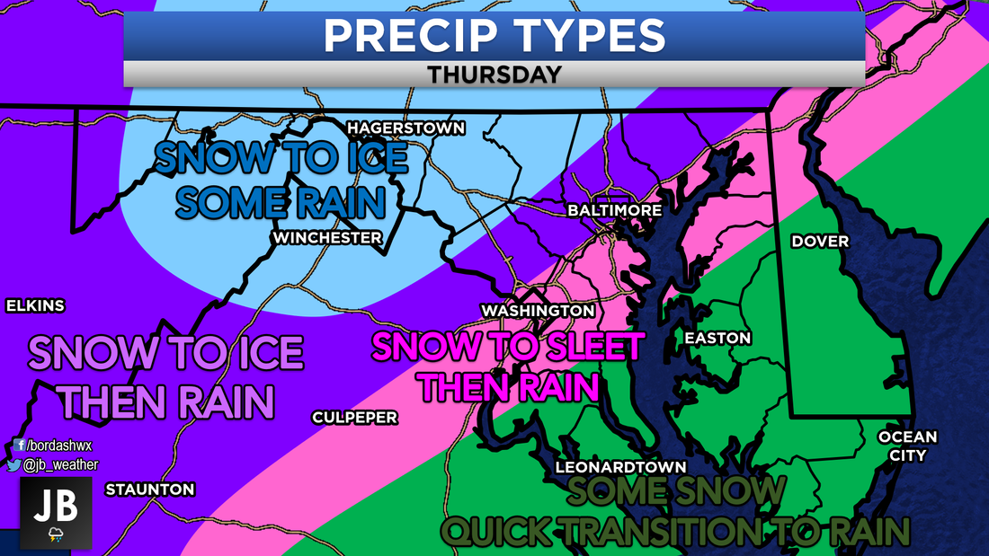 How much will all of this accumulate to? Generally not much. It will really only be areas north and west of I-95 that will see any snow accumulation. Even in these locations snow probably won't stick to the roadways. Ice will likely also accumulate in the valley's to our west. Below are my predicted ranges.
Impacts across the area will likely be due to this transition to rain that could include ice. This impact will be the most pronounced where the transition takes longer. It will be areas along I-81, I-70, I-270, I-83, and I-66 that could see the highest impacts. Locally, in Southern MD there should be low impacts. It will not be until you hit Prince Georges and Anne Arundel Counties where impacts become elevated with slick spots. 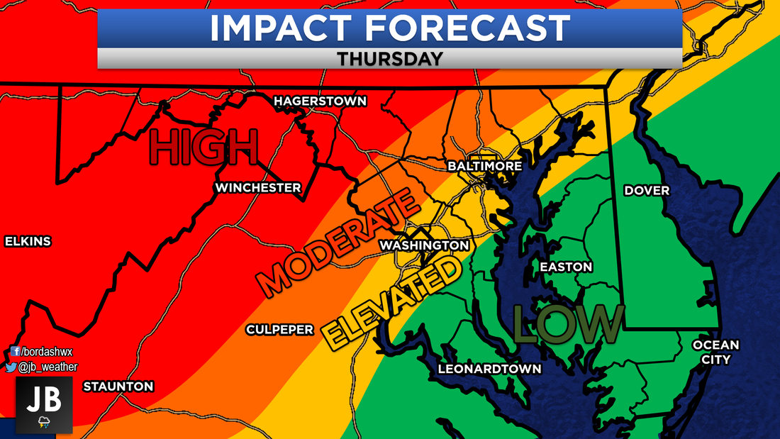 How will these impacts effect area schools? Closings are likely (over 50%) for western MD. School districts along I-95 and to the immediate west will likely see some delays. Closings are also possible here (about a 25-30% chance). For the lower Piedmont counties along I-95, delays are only possible with a 30% chance. Elsewhere, I'd plan on a full day of school. 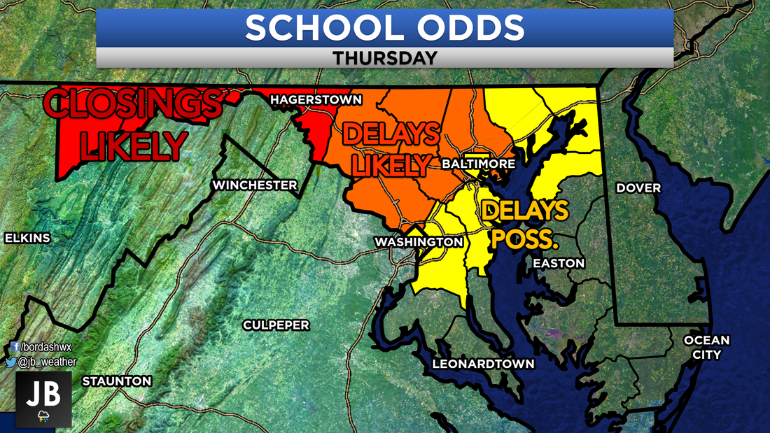 By and large, this will be your typical, "I-95 and west," storm. It will be these typically colder locations out west that see the majority of the wintry precip. That's the name of the game with these early season storms. Regardless, there will be a lot of moisture across the area. Rain and snow could be heavy at times. I believe this only the beginning to along and active winter. Next week, however, looks to be uneventful and seasonal! Nevertheless, keep it locked in with Southern MD's most trusted weather source, JB Weather for the latest!
-John A. Bordash
0 Comments
Leave a Reply. |
Archives
August 2020
Categories
All
|
 RSS Feed
