
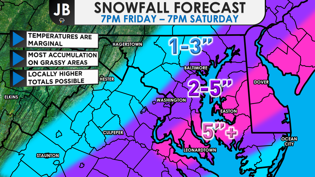
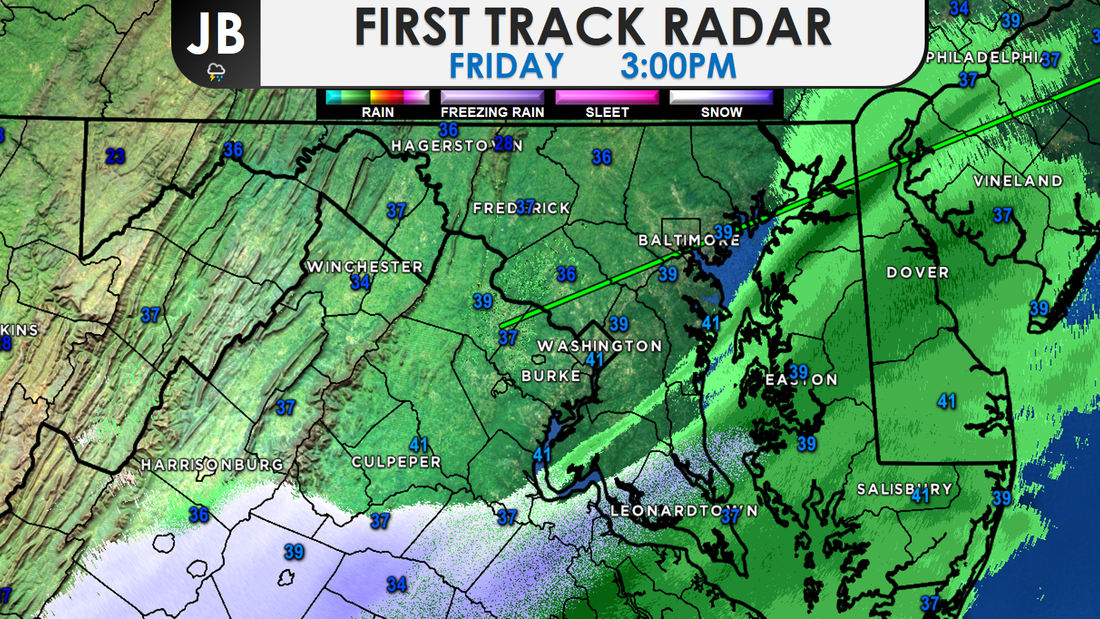
 A classic Southern storm will move up the coast today, wrapping in moisture and cold air, and producing a wintry mess of precipitation. Rain or a rain/snow mix this evening is likely to gradually transition to wet snow overnight and into tomorrow-- that could be moderate to heavy at times. Several inches are possible for areas east of I-95, with most accumulation on grassy areas. However, as snowfall rates pick up and darkness settles, slick roads will become a possibility. The snow ends before midnight. Sunshine returns Sunday, but it will be on the brisk side. I am confident that we'll have a sloppy mix of precipitation and that it will change to snow. The big questions are will it snow hard enough and will temperatures fall quickly for snow to accumulate, as I detailed this morning. The National Weather has hoisted Winter Weather Advisories for all the locations in purple. Generally, I'm expecting 2-5" east of DC, in the advised area, and 1-3 west of DC. A Winter Storm Warning, shown in pink, has also been issued as a heavier band may try to bring 5"+ of snow to Southern MD, and potentially to Delmarva as well. 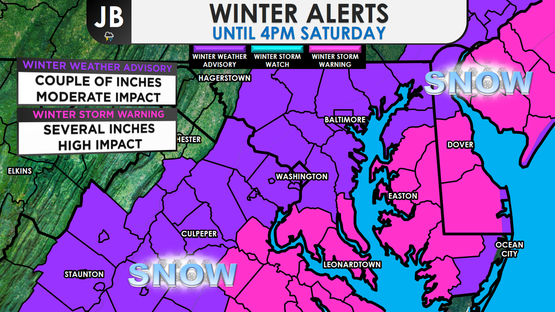 A significant obstacle for snow accumulation is the relatively "warm air" that will be in place when the precipitation first arrives (in the upper 30s to 40s in some spots). It will take some time for the precipitation to cool the air and for precipitation to change from a rain (or a rain/snow mix) to snow. In the past, some of our biggest underperforming snow events have occurred when the changeover to snow took longer than expected. And, the warm ground could limit accumulations. Precipitation has already started to move into the area. Early rain starting to mix with some snow and sleet already, which does bear good for snow lovers. Right now, all the precip is light, but it will pick up in intensity tomorrow. When will the heaviest snow fall? Most likely from sunrise to late morning.
We have talked about this storm potentially not bringing as much snow as the forecast called for. The next question is, could the storm bring more snow than expected? Yes. In order for this happen, we will need heavy precipitation to develop. That will serve to cool the air and high snowfall rates might overcome the effect of the warm ground. There's a 1 in 4 chance of 6-8" in a few spots. For that to happen, temperatures will need to be lower than forecasted, and as mentioned, heavy bands do need to set up.
Overall, as a snow lover, I'm liking what I see for this storm. All the ingredients are coming together for a decent December snowstorm, especially for Southern MD and Delmarva. A lot things are at play here, and there are a lot of variables. Stick with JB Weather for the latest updates and continued coverage! Lead Forecaster -John Bordash
1 Comment
Amy
12/9/2017 05:50:34 am
Neglible snow at 8:50AM- 20878 Leave a Reply. |
Archives
August 2020
Categories
All
|

 RSS Feed
