
|
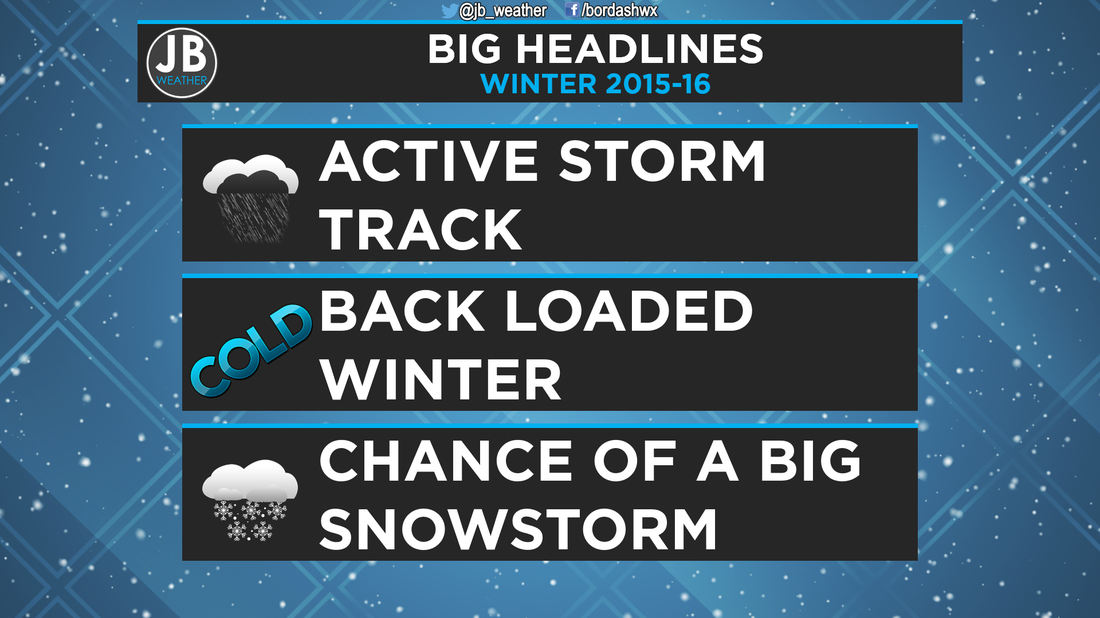
Winter 2015-16 Forecast Video Over the past few winters, it’s either been feast or famine. In 2009-10, we saw an unprecedented three blizzards that gave us a record 56.1” of snow that winter. However, just two seasons later, we saw a virtual snowless winter with no one storm dropping over 1” of snow. Last year, winter did not get its act together until February when we saw record cold days along with a 6-10” snowstorm that came in route to a seasonal total of 16” by March. The question everyone is asking is, “what will this winter hold?” Behind the ForecastEl Nino Southern Oscillation (ENSO) This winter, I expect that the equatorial Pacific waters will have a big influence on our weather patterns. The area we watch is called the El Nino Southern Oscillation. When the waters are warmer it is referred to as El Nino. Cooler waters are referred to as La Nina. Right now, we’re not only sitting in a El Nino phase, but a strong one as the water temps are well above average. I expect for these waters to begin to cool which will lead to a weakening El Nino through the winter and into Spring. 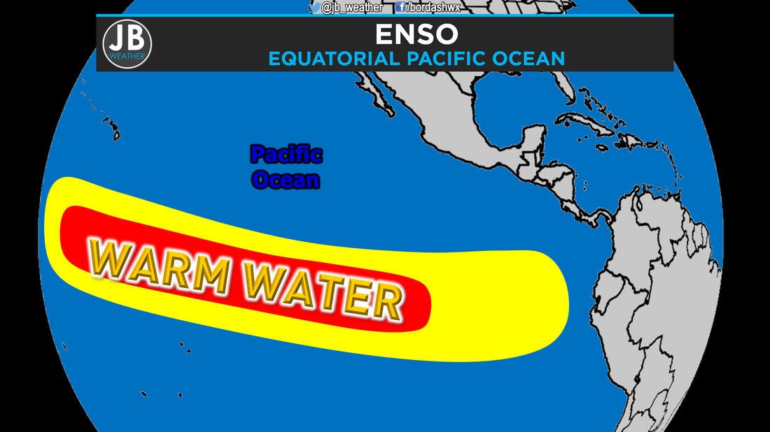 Pacific Decadal Oscillation (PDO) Another area of water we watch for implications on our long term weather patterns is the Pacific Decadal Oscillation, which is in the northeastern Pacific. Right now, the waters are warmer than average, and that could help bring down cold air to our region. 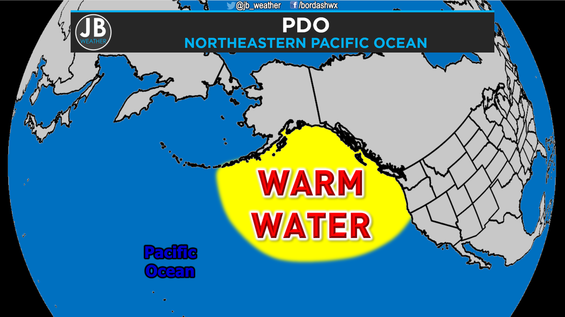 Northern Hemisphere Snow Cover To determine if there will be a lot of cold air to our north, a key sign is the amount of snow cover across the northern hemisphere in the fall months. Scientsist have proven that there is a direct correlation between the amount of snow cover to the north and how cold our winters are. More snow cover can lead to colder winter. There is an abundant amount of snow to our north, which signals that there will be a lot of cold air ready to come down, the question is when. 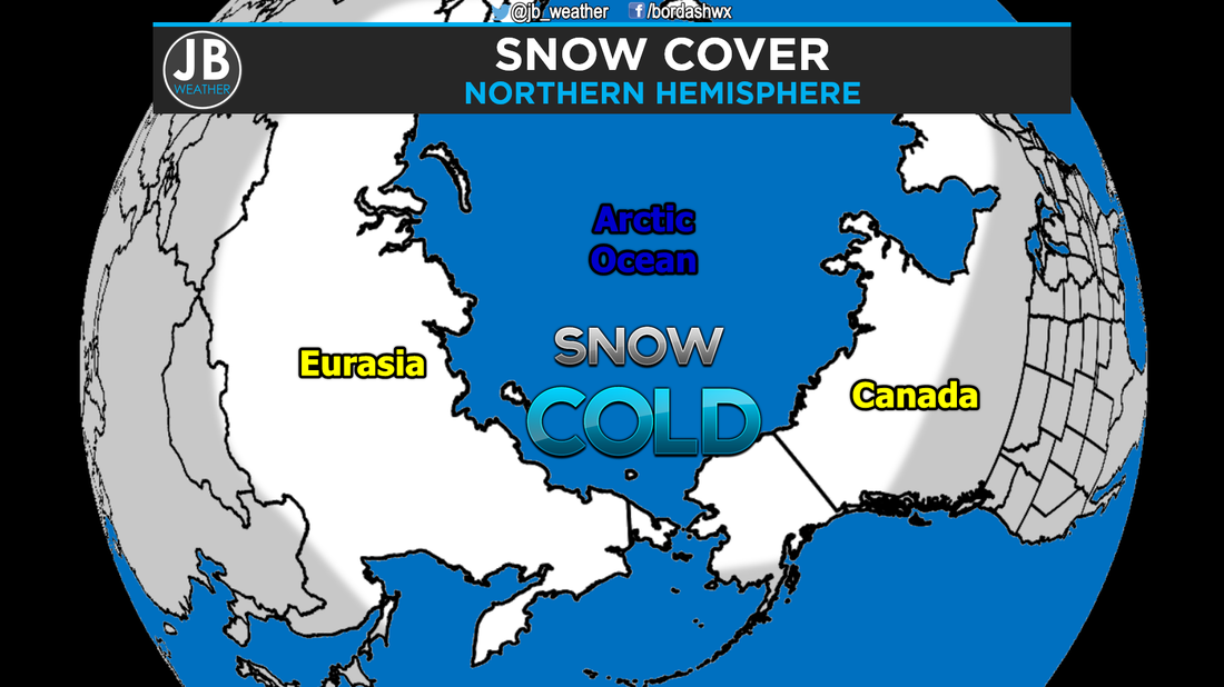 There are other short term factors that impacts our patterns, but they change too much to be able to forecast them this far out. The ForecastDecember & January I think that through the first half of winter, We will see an active southern jet stream that will help to bring storm systems from the Pacific, across the southern tier of the country. One of the bigger questions is how far north the precip gets. However, I don’t think that during this time period we will see a lot of cold air, so for any storms that get moisture this far north, the precip will rain rather than snow, as the northern jet stream will be well to the north. I suspect, that due to that, the northern half of the county will be warm and dry, while the southern half will be cool and wet. I think here in Maryland, we’ll see a warm, but wet first half of the winter. February & March In late January/early February the pattern changes. In February and March we’ll start to see our southern jet stream pick up storms from the Gulf of Mexico, and drive them either just to our south, or up the coast. I think that the northern jet stream will be allowed to come south, delivering some cold shots to our region, but nothing like the past two winters. However, if we can time these cold shots and storms out right, we could see a big winter storm. I believe that the south east sees a cool and wet pattern remain, but the Mid-Atlantic will turn wintry. Meanwhile, the west coast returns to a warm and dry pattern. Total Winter Snowfall Forecast In Southern Maryland, we average 12-14” of snow. I think that we’ll see 10-15” this winter, but we could see all of that from one or two late season storms. Now, if we see a really active track, I could see us getting a lot more than this. The coast will see less, with areas north and west seeing more. DC should see 15-25” of snow, with their average being 15.4”, and the mountains seeing the most snow.  Bottom Line
 Snow Day Forecast This winter, I think that public schools will be closed for 4-7 days this winter, all due to a few snow storms. 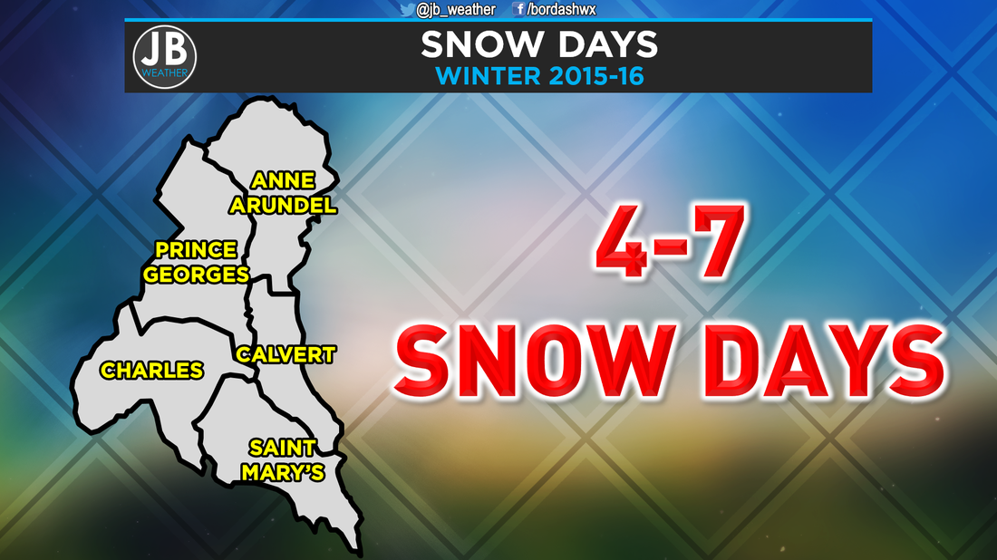
0 Comments
Leave a Reply. |
Archives
August 2020
Categories
All
|
 RSS Feed
