
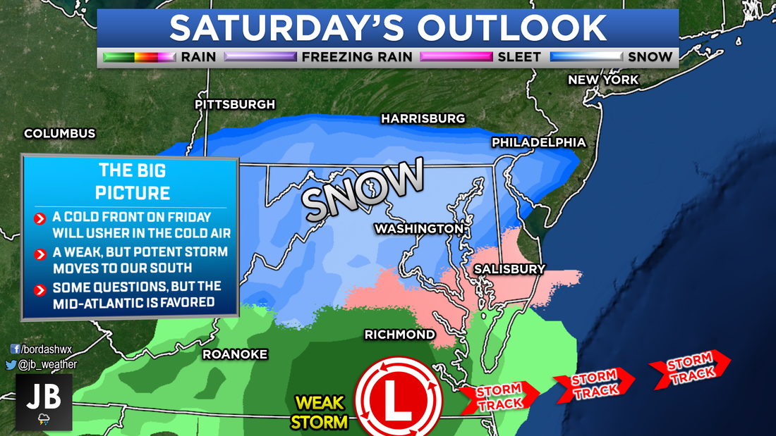
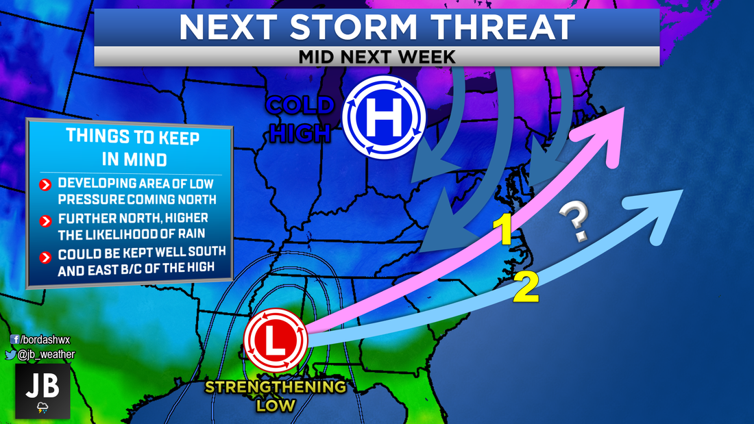
 The middle of February id looming, which is Southern MD's climatological snow peak. Accordingly so, our winter storm threats look to be increasing. Right now, I am monitoring three potential threats over the next 7-10 days. The first winter storm threat looks to be during the day on Saturday. This does not appear to be any sort of crippling, record setting blizzard. However, it does look like a decent shot of some accumulating snow. Initially, we will have a brief warm up on Thursday and Friday. An area of high pressure off the coastline will help to pump in some warm temperatures. Highs the next two days are likely to be the upper 50s to near 60! The cold front will move through Friday afternoon. There could be a few rain showers associated with it, but that is it. The cold front will stall out just to our south, ushering in the cold air; and essentially being used as train tracks to guide the Saturday system. 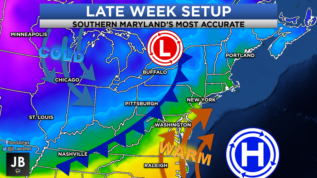 The cold air that will move into the region this weekend will not be, "Polar Vortex," like cold air. It will bring temps down to the lower 30s, but that is all we need for snow. Coming off such warm temperatures the day before, it looks like any precip that falls will initially start as rain and then transition to snow. Generally speaking, I am not expecting amazingly high snowfall totals with this storm. Shown below are my thoughts, and it looks like a nuisance sized-event is likely. However, because the system is weak, there is a higher degree of uncertainty. If the storm is slowed down a touch, or is further south, that could bode well for snow lovers. My First Call map will be out tomorrow! 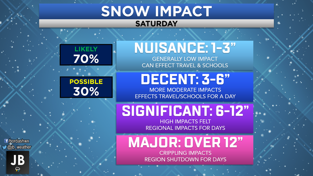 Looking ahead, our next two winter threats are on Sunday and then again on Tuesday/Wednesday. Below I show my initial thoughts for each.
There is a lot to watch over the next 7-10 days. In its last month, winter may finally be trying to get itself together. Our first and most concrete threat comes Saturday. Even though we still have some questions surrounding track and temperatures, it looks likely that someone in the Mid-Atlantic will receive some snow. My first call snow map will be out tomorrow afternoon. Stay with JB Weather on Facebook and Twitter for the latest updates and most complete coverage!
Lead Forecaster -John A. Bordash
1 Comment
Dee
2/13/2019 04:27:55 pm
Let’s push for snow, you do a great job and I follow. Thanks for all the hard work. Great for all up dates for southern Maryland . Leave a Reply. |
Archives
August 2020
Categories
All
|

 RSS Feed
