
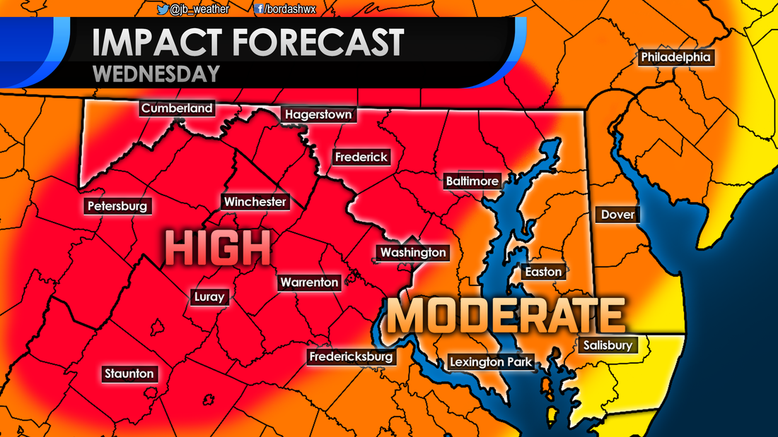
 A significant winter storm still looks likely to strike the Mid-Atlantic on Wednesday. Winter weather conditions will over spread the area early tomorrow morning before transitioning to a period of ice then rain in the afternoon. Some details have come into better focus since yesterday. locally, I am still expecting a moderate impact that will likely close schools and cause travel difficulties. The National Weather Service has now issued a Winter Storm WARNING for a large chunk of the Mid-Atlantic from I-95 to the north and west. This is where the highest snow totals will be and where ice totals will have the highest impact. Across the coastal plain, including Southern MD, it's a Winter Weather ADVISORY. Snow and ice totals will not be as high here, but winter weather is still expected. 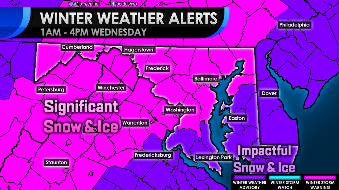 Snow still looks likely to move into the region between 5 and 8 in the morning. A change to this part of the forecast is that it looks like coastal areas in Southern St. Mary's and Calvert (locations closest to the opening of the Bay) may be a touch warmer. This could lead to localized areas of sleet or freezing rain developing there first. You can see that develop throughout the morning on the Futurecast below. Light to moderate snow continues until we hit the lunch hour; that is when the regional changeover to sleet and freezing rain will start. The most recent model runs have shown a dry slot potentially developing over area south of Route 231 by midday, as shown below. If this happens, snow and ice totals will likely be kept down. If you remember back to the January storm, many saw that dry slot happen, lowering their backyard totals just a bit. It looks like the heaviest snows will indeed stay north and west of DC. It is also there that ice may hang on the longest. This model's automated snow output very much agree's with my forecast. I do agree the idea that the heaviest snows may be kept to the north and west, away from Southern Maryland. Areas northwest of I-95 likely see over 4" of snow from this storm. Along I-95, including PG and Anne Arundel Counties, 3-5" looks likely there. Across Southern Maryland a general 2-4" looks likely, especially for those north of Route 231. South of that point across southern Calvert and St. Mary's County 1-2" is likely there. Our local forecast is very dependent on that dry slot. If it does indeed occur, then your backyard totals will likely be on the lower side. If that dry slot does not happen and heavier snows work in, then totals will be on the higher side. 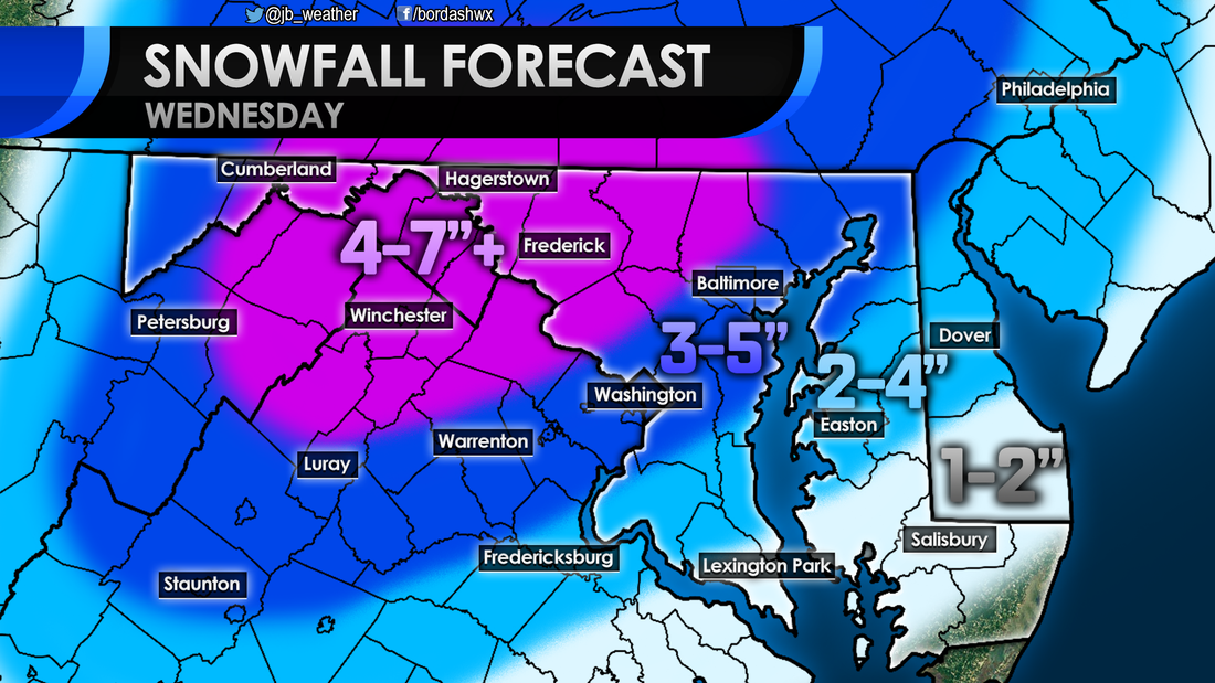 The same general rule of higher totals north and west of I-95 will hold true for the ice as well. High impacts from ice, totaling over 1/4" of an inch, looks likely in the MD/WV panhandles and across the Shenandoah Valley. From there to I-95 a moderate impact from ice totaling from 1/10" to 1/4" seems likely. It is in these two zones that Ice is almost certain for some period of time. From I-95 to the southeast to Route 231 an elevated impact from a glaze of ice will be possible. Coastal locations may be spared from ice due to that dry slot. 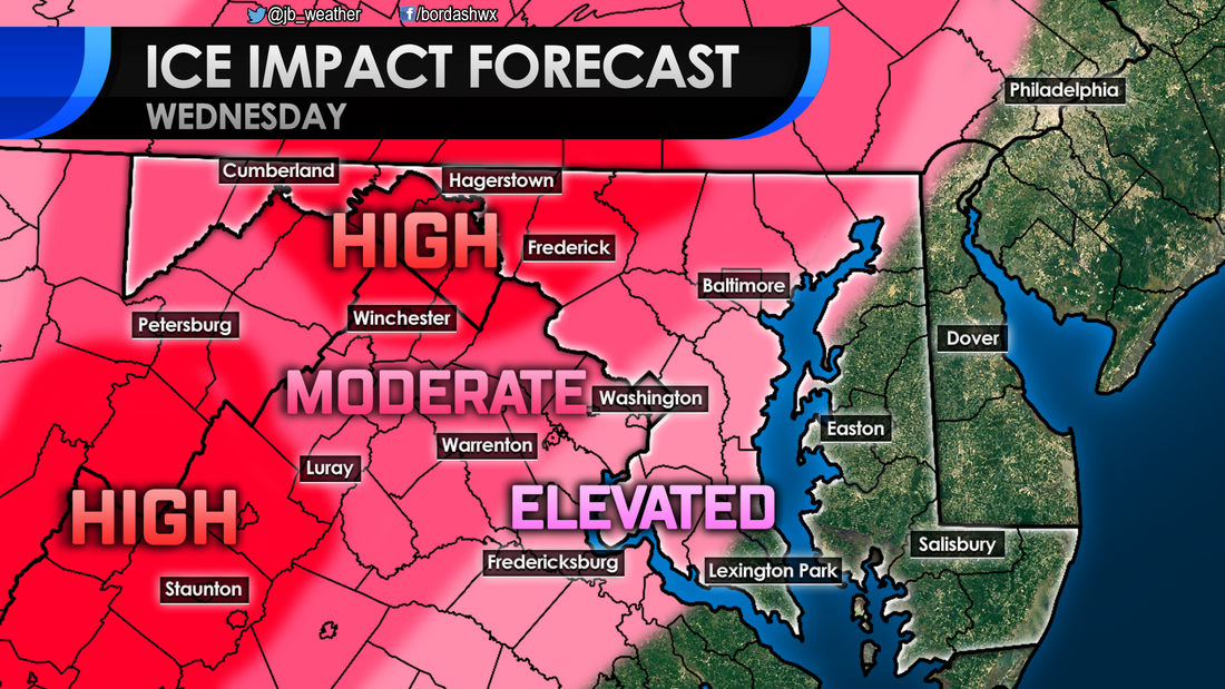 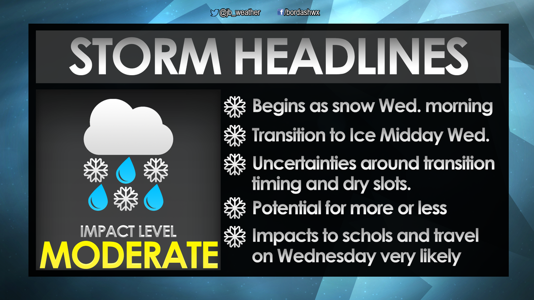 A moderate to significant impact winter storm still looks very likely for the Mid-Atlantic. I expect widespread school closings and travel difficulties. The biggest change from yesterday is that it looks like a developing dry slot may spare Southern MD from significant ice and snow. Regardless, moderate impacts are still likely though mid-afternoon. I will continue to provide updates throughout the day tomorrow to keep you ahead of the storm. Follow me on Facebook or Twitter for Southern MD weather updates!
Lead Forecaster -John A. Bordash
0 Comments
Leave a Reply. |
Archives
August 2020
Categories
All
|
 RSS Feed
