
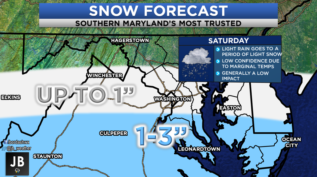
 Snow still looks likely for Saturday across the Southern Mid-Atlantic. A weak area of low pressure will move to our south, overspreading moisture across the forecast region. The precipitation will be met with cool temperatures in the 30s. This set up should allow for an initial burst of rain to switch over to some light snow by midday/early afternoon on Saturday. This never has, and still does not look like a blockbuster snowstorm for our area. This should really only be a minimal event at best. As things stand right now, it looks like precipitation should move into the region during the early-to-mid morning hours. Starting as rain, we should see a transition to snow by lunch time. Relying on this transition to occur does make me nervous. There have been plenty of times where a set up like this has not produced snow, and leads to a busted forecast. This is why this forecast is a low confidence one. Shown below is the in-house Futurecast. It shows that timeline of rain going to snow by the afternoon well. Again, not looking at heavy snow, just a light but sustained light snow. Shown at the end is forecasted amounts from the American Model. While this is not my forecast, it does should that the higher snow totals will be south of DC. This should be a low impact event for many; especially since this a Saturday event. Nevertheless, this could make roadways a tad slick. With the warm temperatures on Friday, and above freezing temps on Saturday, not too much should stick to major roadways. Most accumulation should be on grassy areas. Considering this storm is weak, that means there is a higher degree of variability with the forecast. These smaller system are notorious for making last minute track and atmospheric changes. A move just 30 miles to the north could tack on another inch or two to the forecast, and bring in heavier snow. On the other hand, if this system tracks 30 miles to the south, Southern MD will not see much at all. Both of these options are very much on the table. As things stand now, a nice 1-3" of wet snow look to fall on Saturday across the region. This low impact event will have marginal temperatures to contend with, which could lead to lower snow totals. Stay with JB Weather for the latest updates on this changing forecast. 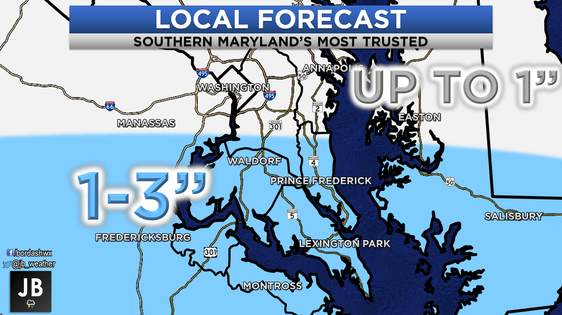 Lead Forecaster
-John A. Bordash
1 Comment
|
Archives
August 2020
Categories
All
|
 RSS Feed
