
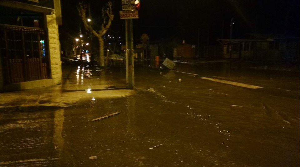
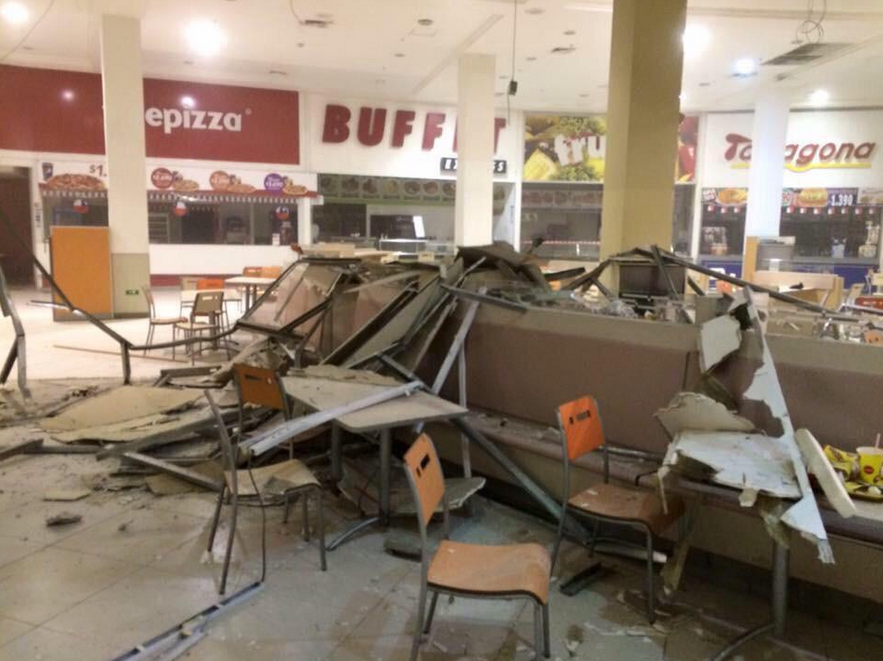
 Based on all available data a tsunami may have been generated by an 8.3 magnitude earthquake that hit the South American county of Chile earlier this evening. An investigation is underway to determine if there is a tsunami threat to Hawaii. As a result, a TSUNAMI WATCH has been issued for the entire state of Hawaii. A Tsunami can be extremely destructive to coastal areas. If tsunami waves impact Hawaii the estimated earliest arrival of the first tsunami wave is: 9:11AM Eastern Time (3:11AM Hawaiian Time) 9:00PM UPDATE: A 10.2 foot tsunami has been observed in Chile. We have pictures beginning to come in. The TSUNAMI WATCH remains in effect for Hawaii. Below are pictures of waves crashing onto the Chile shoreline, as well as the aftermath of the earthquake, provided by @EduardoElTiempo
 9:40 PM UPDATE: Based on all available data, a major tsunami is not expected to strike the state of Hawaii. With that in mind, the TSUNAMI WATCH has been downgraded to a TSUNAMI ADVISORY. However, sea level changes and strong currents may occur along all coasts, and that could be a hazard to swimmers and boaters as well as to persons near the shore and at beaches in local harbors and marinas. The threat may continue for several hours after the initial wave. The estimated arrival time for the initial wave is: 9:11AM Eastern Time (3:11AM Hawaiian Time).
0 Comments
 The Metropolitan Washington Council of Governments, in association with the Maryland Department of the Environment, the Virginia Department of Environmental Quality, and the District Department of the Environment has issued a CODE ORANGE AIR QUALITY ALERT (in the dark gray zones) for the DC Metro area, Northern Virginia, as well as Central and Southern Maryland on Thursday.
A CODE ORANGE AIR QUALITY ALERT means that air pollution concentrations within the region may become unhealthy for sensitive groups. Sensitive groups include:
The effects of air pollution can be minimized by avoiding strenuous activity or exercise outdoors. 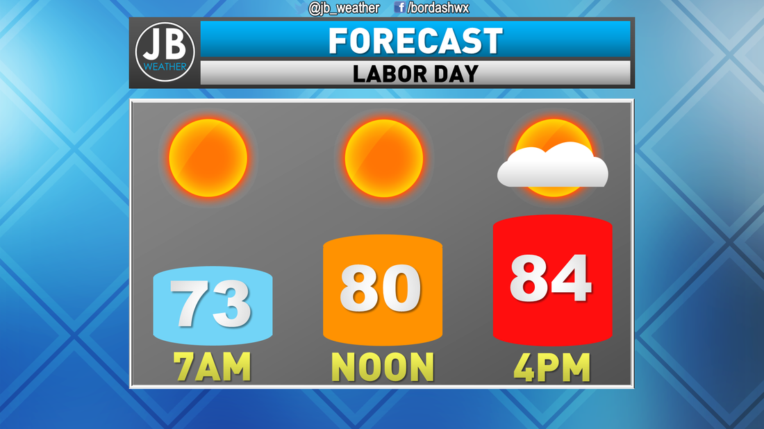 Labor Day looks to offer up some great weather! Temps should only max out in the lower to middle 80s across Southern Maryland with mainly sunny skies. We may see some random clouds move in throughout the afternoon/evening. I think that most of the region should remain dry, but I can't completely rule out a quick passing shower. I would put the rain threat at 5-10% right now. Lastly, we will have to continue to deal with some humidity tomorrow. Now, it will not be as high as it was last week, but it will be noticeable. Have a great Labor Day! -JB
|
Archives
August 2020
Categories
All
|

 RSS Feed
