
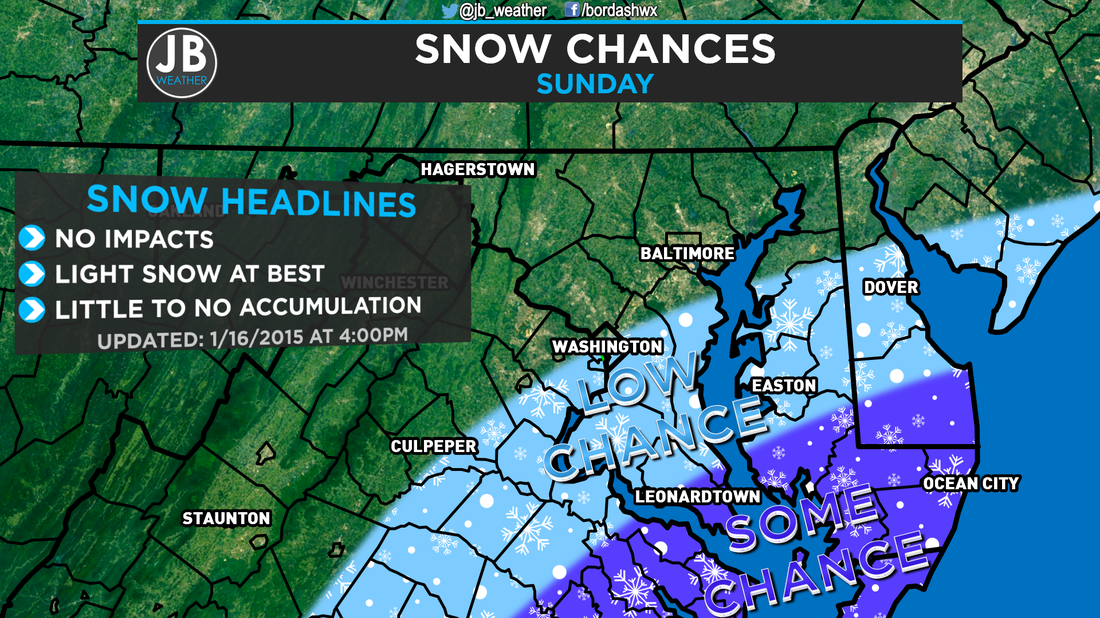
 Current forecast for tomorrow's snow chances. Over the past few days, there has been some talk over a system that will be sliding well to our south, off the Southeast coastline. At one point, the American Model had even showed a sizeable snow event for area. Needless to say, that doesn't appear likely. However, we could see some flurries or snow showers tomorrow. As shown above, our forecast is that there is at least some chance (30-40%) that the purple areas see some flakes, while the blue areas have a low chance (20-30%) at flakes. This storm will be sliding well to our south, so don't expect much. Will this be a big blockbuster storm? Nope. But this could offer some conversational snow. In addition to a storm track that is too far south and out to sea to give us a decent snowfall, temperatures could also become an issue for whatever precipitation does fall. Temperatures tomorrow will max out in the upper 30s and lower 40s. While it's not impossible to snow at those temps, we could have some very light rain showers that mix in as well 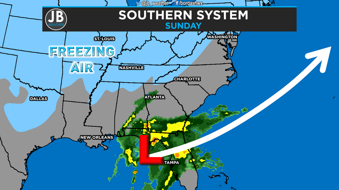 Projected location of the system early tomorrow morning along with its predicted storm track. Freezing air, shown in blue, could be too far north to have all precipitation fall as snow. All in all, tomorrow should not be an active weather day. We could see some snow or rain showers that work in across the area. The further south and east you head, higher the chance for precipitation. Below are the chances for accumulation amounts. 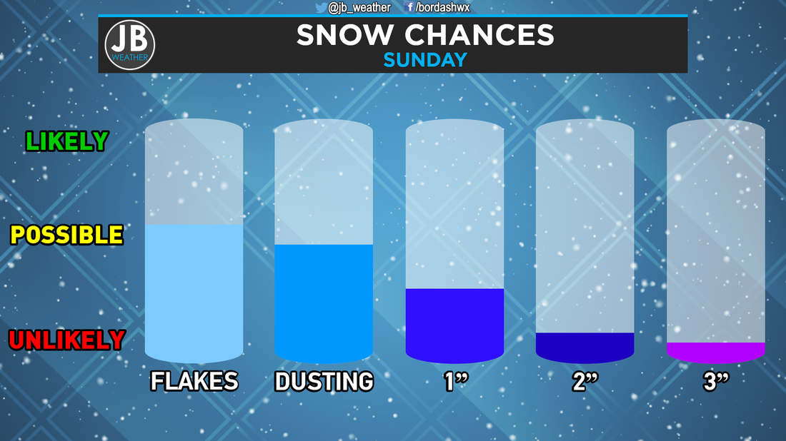 Tomorrow's snow chances for Southern Maryland. I cannot believe that in mid-January, this storm has the best shot to bring us snow thus far, and it'll be minor amounts in the best setup! Nevertheless, stay with JB Weather for the latest on all things Southern Maryland weather!
Lead Forecaster -John Bordash
0 Comments
Leave a Reply. |
Archives
August 2020
Categories
All
|
 RSS Feed
