
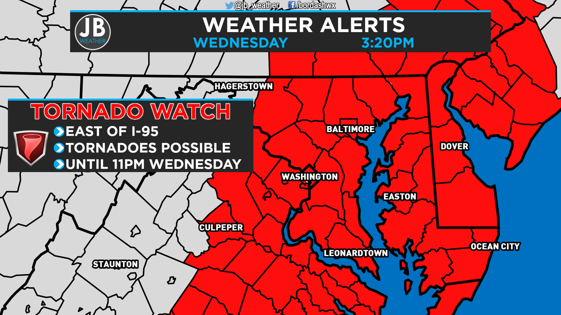
 The Storm Prediction Center in Norman, OK has issued a TORNADO WATCH for Southern Maryland, and areas east of I-95. This watch is in effect until 11PM Wednesday.
Primary threats this evening are:
SUMMARY: Ongoing strong to severe storms over part of east central and western North Carolina should progress northeastward into the evening hours. These storms could also bring the threats for tornadoes and damaging wind gusts. PRECAUTIONARY/PREPAREDNESS ACTIONS: Remember, a Tornado WATCH just means conditions are favorable for tornadoes and severe thunderstorms to develop, nothing is occurring right now. People in the watch area should be on the lookout for threatening weather conditions and listen for later statements and possible warnings if severe weather or tornadoes are imminent. Stay with JB Weather for continuing coverage on Southern Maryland severe weather. Lead Forecaster -John Bordash
0 Comments
|
Archives
August 2020
Categories
All
|
 RSS Feed
