
|
A weak system moving to our south late Thursday into Friday will usher in the chances of wintry weather across the region. This is all apart of what I view as Winter's Last Gasp. After the middle of next week, the pattern turns unfavorable for wintry weather. We will have a few shots of wintry weather until then. As mentioned before, the first one comes overnight Thursday. Shown above is Futurecast timing this system out. This system is not strong at all, so I'm not expecting heavy precipitation with this event. Nevertheless, a rain/snow mix will begin to move into far western zones around midnight. Temperatures across the region will continue to fall as the precipitation pushes eastward. With marginal temperatures south of DC, I'm not sure how much will fall as snow here. This looks to be just a sleet to rain event locally. However, once you head north of DC, it will be possible you can see a few hours of light snow. Shown below is the snowfall output from Futurecast. Remember, that is not my prediction. 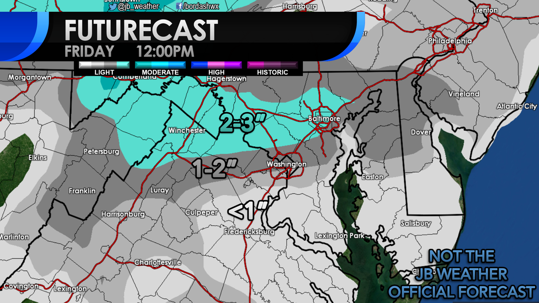 Where the precipitation stays mainly snow will be where the higher totals are. It looks like the favored zone with this event will be in a thin area from the northern DC beltway to the Mason Dixon Line. South of there, it is likely to be a snow/sleet/rain mix. Marginal temperatures will make it hard for snow to accumulate across this zone. Across the Tidewater of VA, to southern St. Mary's County, and the southern Delmarva, this looks to be a mainly rain event. Some sleet is possible here, but I do not think it will be much. Shown below is a depiction of who should see what type of precipitation and my First Call on snowfall. 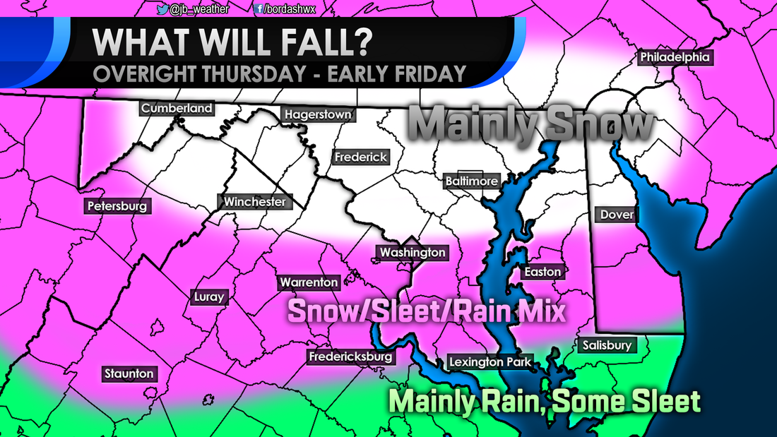 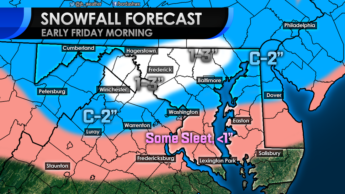 C-2" means a Coating to 2" By and large, I am not expecting a high impact event for anyone. These are rather low totals, that should fall overnight. However, the one problem here is timing. The mix of sleet and snow could have a moderate impact for northern areas Friday morning. Across Southern MD it is an Elevated impact. Some sleet could accumulate in colder locations and, "back roads." By-and-large though I am not expecting much. 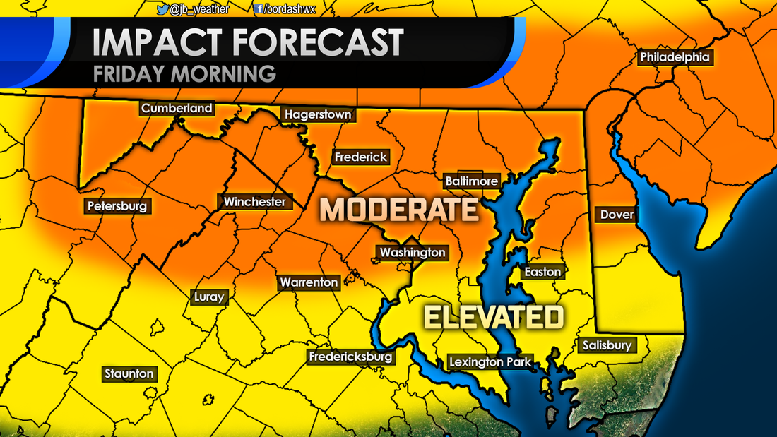 Moving forward, our next credible storm threat comes at the beginning of next week. A storm will move north from the Gulf Coast region. A high pressure to the north will dictate where this storm goes. If the storm take a track that's more to the north, warmer air will get pulled in and we will see rain across the Mid-Atlantic. If this storm takes a more southern track, we could see some wintry weather to kick off the week. There are a lot of variables at play, so not that much is known. This picture should be clearer by weeks end. 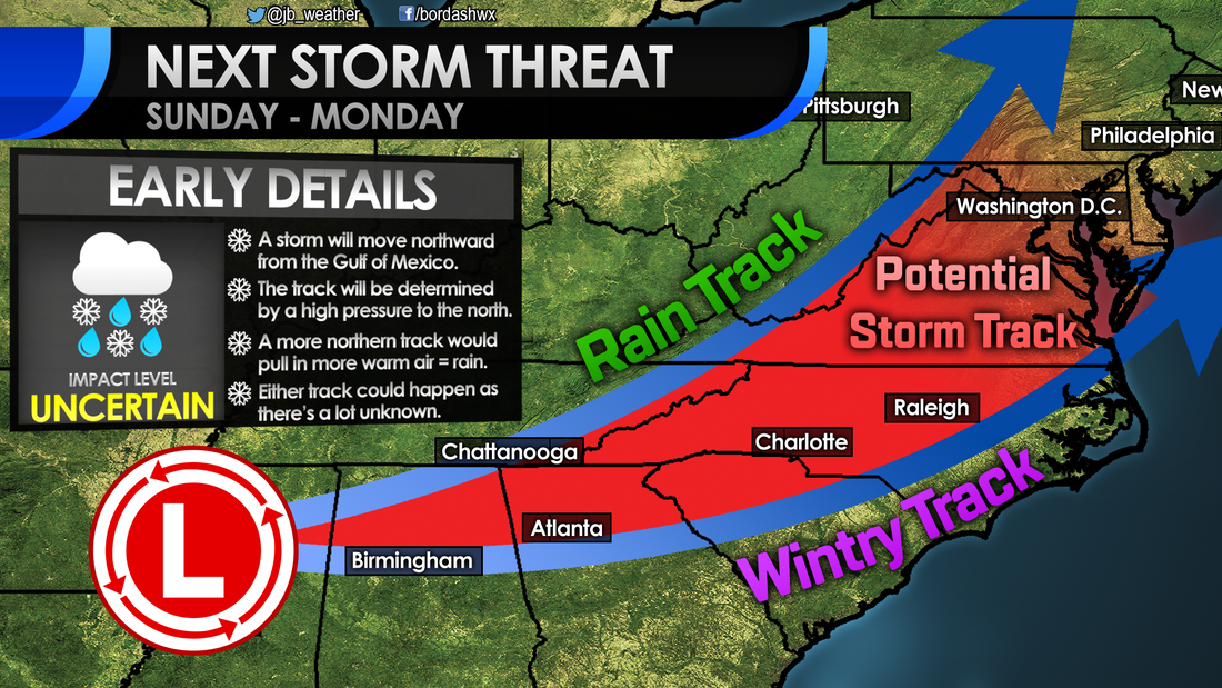 Needless to say, there is a lot to watch over the next few days. Up first will be this quick shot of winter weather overnight Thursday. I'm not expecting much snow or sleet to fall, but enough could fall at the wrong time to cause some school and travel delays. I'll be updating this forecast throughout the day tomorrow, stay tuned.
Lead Forecaster -John A. Bordash
0 Comments
Leave a Reply. |
Archives
August 2020
Categories
All
|
 RSS Feed
