
|
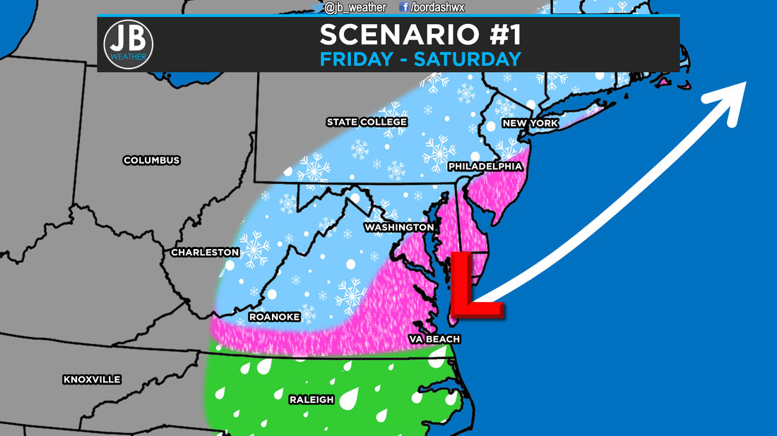
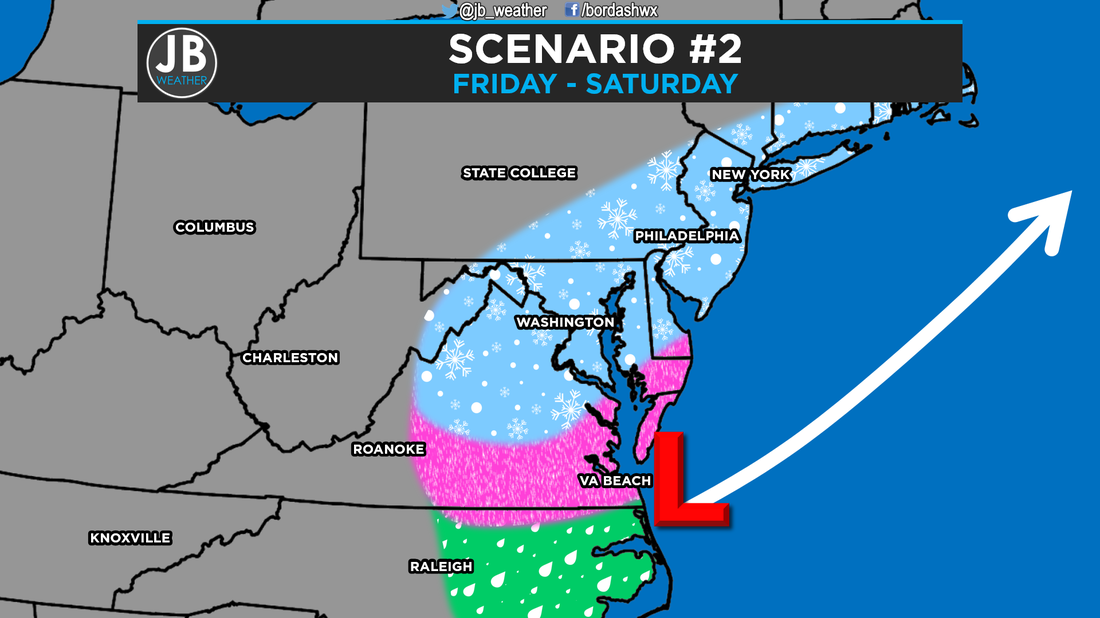
Long video discussion about the storm. Everything I talk about in this video is also talked about below in the blog update. Next Chance of Accumulating Snow: Friday - Saturday Probability of Accumulating Snow (1" or more): 90% It looks like we could be facing our first potential major winter storm late this week. Cold air being driven southward will converge with precipitation being pushed northward Friday into Saturday. However, our cold air is not expected to exceptionally strong, and the potential snow could be of a wetter variety along with some mixed precipitation. Due to the intensification of the storm, it looks like we will have to deal with some high winds as well. All of our weather models with this system have been surprisingly consistent this far out. However, expect that the forecast could change a few times as the storm fully get sampled late tonight. Nevertheless, the very active subtropical branch of the jet stream in this pattern suggests that this storm will have an ample moisture supply. Additionally, with a cold area of high pressure to the north of us, in southern Canada, the Mid-Atlantic looks to be in a highly favored position. As usual, the storm track will be a key factor in determining how much and what type of precipitation we see, so I've set up two scenarios for the storms. Below is a depiction of both scenarios.
My early outlook is that this storm will likely be the biggest storm in the past 6 years. I'm favoring a track that's closer to the coast, and one that limits the amount of cold air. Nevertheless, we will still see quite a bit of wintry weather. We may mix with rain at times, but that's to be expected with winter storms. I believe that this storm's "bullseye" will be centered right on the Mid-Atlantic, but away from the coast. Below are my chances on what type of winter storm we will be dealing with.  Storm potential for Southern Maryland. The Bottom Line is to expect a winter storm that looks to start sometime either late morning or midday Friday that lasts until sometime Saturday afternoon. There are still a few unknowns, mainly concerning storm track, which ultimately affects precipitation type. It's still too early to put out any snowfall forecast numbers with this storm, but nevertheless, this will be a high impact storm with high winds. This forecast still has the potential to change over the next few days with new information that comes in. However, if you're planning on flying out Friday afternoon or anytime on Saturday, your flight is likely to be delayed or canceled. You may be able to get out Friday morning, and definitely on Thursday. 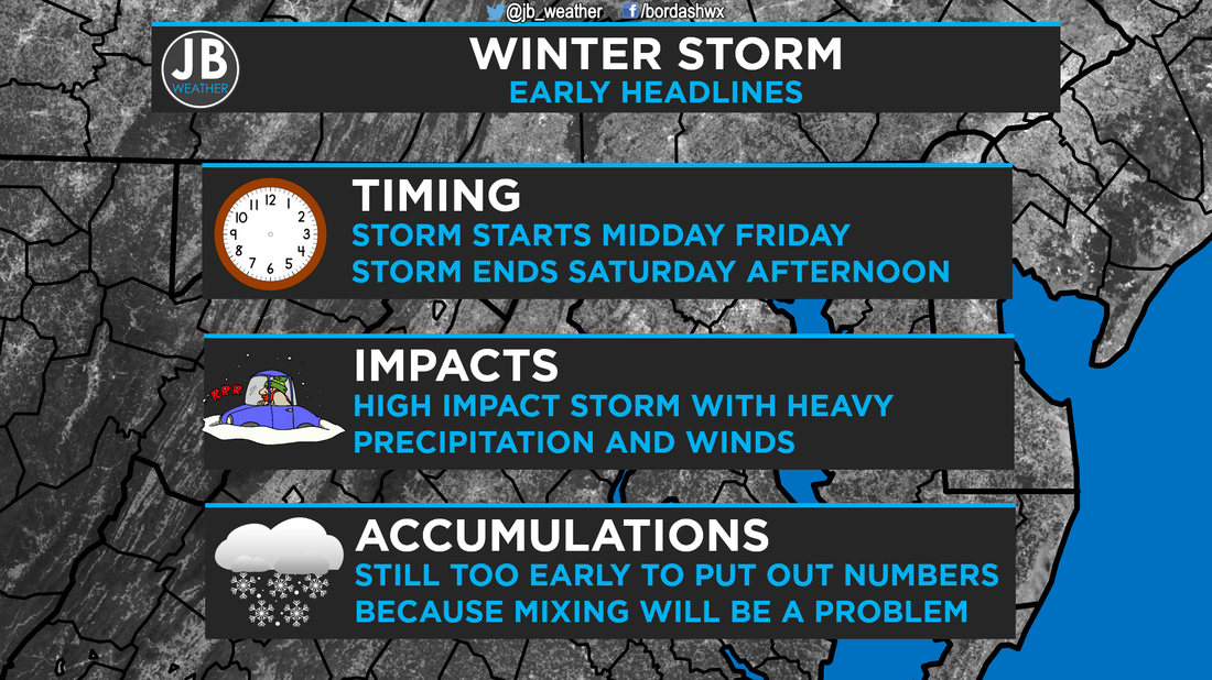 Stay with JB Weather for the latest information on Southern Maryland weather. I plan to have my first call on snow totals sometime tomorrow, probably in the afternoon or evening. Lead Forecaster -John Bordash
0 Comments
Leave a Reply. |
Archives
August 2020
Categories
All
|
 RSS Feed
