
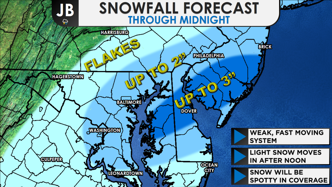
 While this still does not look like a major event-- periods of snow look to move into the region this afternoon. The snow is scheduled to move in around lunchtime, and move out around sunset, potentially effecting the PM commute. Many will see flakes, but only some will see them accumulate. With that in mind, I painted a broad stroke of "Up to 2"" east of I-95, with the idea that some may still only see flakes. The darkest blue area could see isolated amounts up to 3". 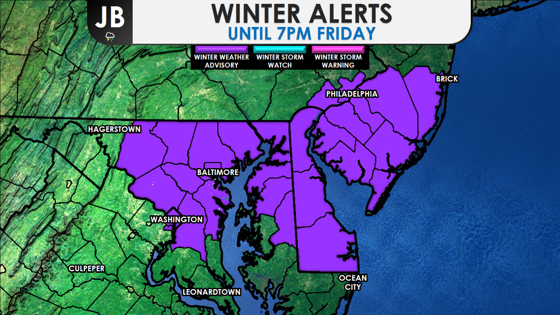 The National Weather Service has issued a Winter Weather ADVISORY from 1pm to 7pm for the immediate D.C. and Baltimore metro areas, as well as northern Delmarva and the southern Philly suburbs. This is where the highest snow totals, potentially up to the 3", looks to fall. In regards to timing, not too much has changed. Snow showers still look to break out across the region around lunchtime, ending around 5pm. As mentioned in yesterday's forecast, it's not really that a lot of snow is forecasted to fall, or that it'll be a long lasting storm that is posing possible issues. The timing is key. The light snow may be falling at just the right time to effect the PM Rush. What's more is that the heaviest snow would be falling right along the metro areas. Every flake that falls will stick, thanks to our recent cold blast that cooled the ground down. Most accumulation should remain on untreated surfaces, but main roads could become slushy if you are under a snow shower for long enough. 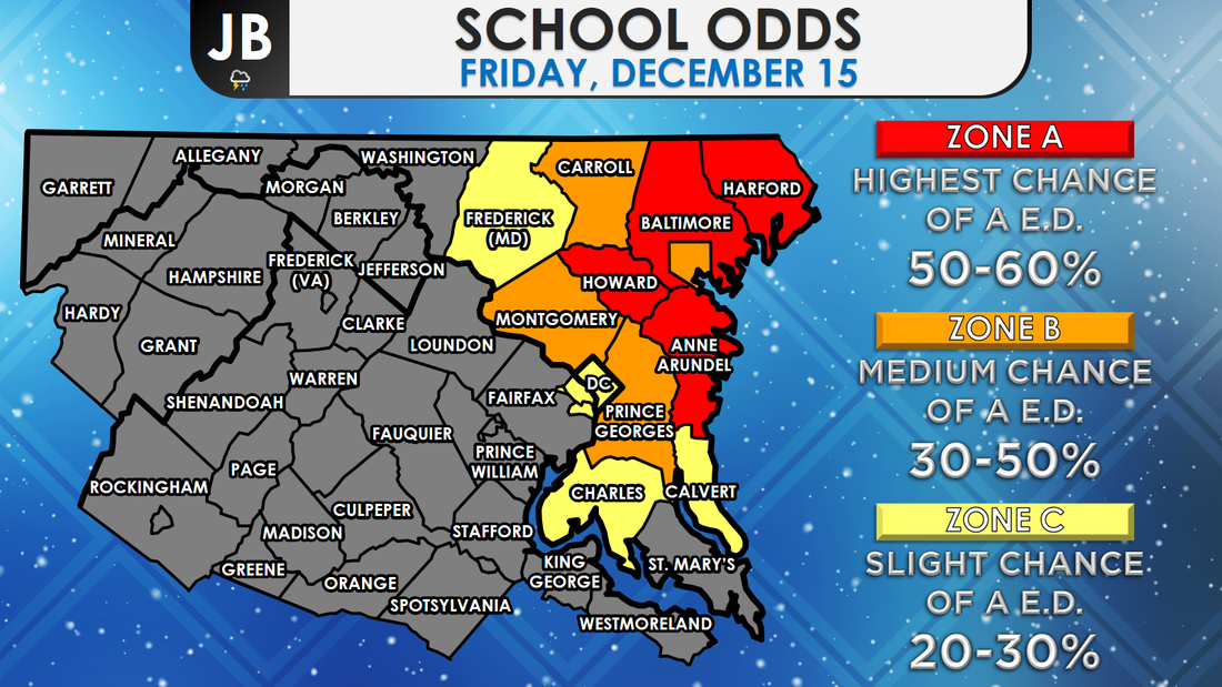 School odds for Friday 12/15. Early Dismissal is abbreviated as "E.D." This could be a very tough call for schools. Snow will likely not begin, assuming it develops, until after a decision needs to be made about early dismissals. The highest chance of these early dismissals should be northeastern school districts, where more snow could fall. This remains a fairly low confidence forecast as the region is on the edge of a storm passing to our southeast. Amounts somewhat lower or greater than the forecast are certainly possible. It is very possible that some locations may see almost no snow while other locations, just a few miles away, could see an inch or two. The further south and west you head, the lower the chance of snow. For example, Baltimore has a higher chance of seeing snow than Leonardtown does. This forecast is really all dependent on how small scale climates set up. The "bust" factor (chance of the forecast not verifying) is very high this afternoon, and I acknowledge. Stay with JB Weather this afternoon and evening for continuing updates on this system and any school alerts.
Lead Forecaster -John Bordash
0 Comments
Leave a Reply. |
Archives
August 2020
Categories
All
|
 RSS Feed
