
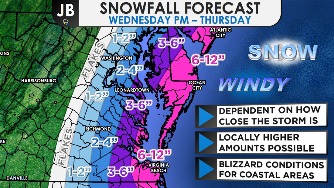
Living on the edge is never easy, and we still sit pretty close with regards to this major East Coast storm. However, it does appear that the storm is taking track closer to the coast, which spells good news for snow lovers. It does look increasingly likely the area will end up with some accumulations, which could end up on the moderate to significant side, especially for coastal areas. Snow starts around midnight tonight, and continues through morning. The heaviest should be right before sunrise. Snow tapers off by lunchtime. For the coastal region, over 6" or so of snow is likely mainly tonight and tomorrow. The heavy snow there will be accompanied by Blizzard conditions (winds over 35mph for 3+ hours). More modest snow will be west of there, around the Bay. Places such as the Middle/Northern Delmarva, Southern MD and Tidewater are on tap for at least 4" of snow. Winter Storm Warnings are largely in place there (except for Southern MD). The lowest amounts will be along I-95, through DC, Baltimore, and Richmond. Those locations should see a general 1-3", and are under Winter Weather Advisories. 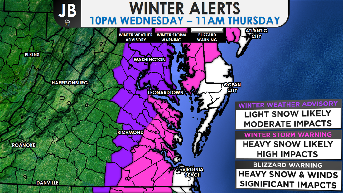 Increased snow totals also means the increased chance of school closings and delays. School districts in Southern MD are almost guaranteed a delay, with Calvert and St. Mary's having a good shot at their first snow day. For counties along and west of I-95, it will be a close call for delay. If the forecast verifies, I could definitely see delays as far west as Montgomery and Prince William Counties. 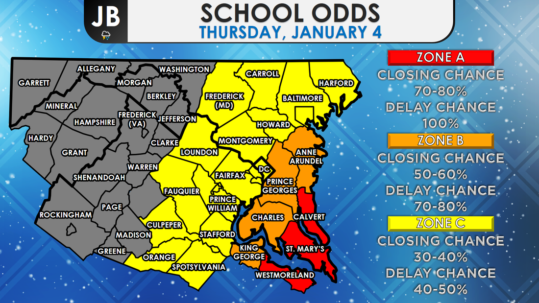 The coastal storm we've been watching the last few days is almost here. Poised to provide us with periods of light to moderate snow. Even though I'm forecasting moderate accumulations across the region, confidence with this storm is still low. A small wobble, either further westward or eastward, would have big implications. And as is the case in most storms, dry air across the region could also hinder snow totals. Locally higher totals could be possible for some, if all aligns right. Nevertheless, as things stand now, Southern MD is in for a decent snow event, with an all out blizzard on tap for coastal areas. Travel will be difficult tomorrow for many. Stay with JB Weather, on Facebook and Twitter, for the latest information.
Lead Forecaster -John A. Bordash
7 Comments
John Bordash
2/14/2022 05:23:27 am
This is an old post, from 2018. 12/20/2022 09:06:58 pm
İnstagram takipçi satın almak istiyorsan tıkla. 1/8/2023 01:44:27 am
100 tl deneme bonusu veren siteleri öğrenmek istiyorsan tıkla. 6/30/2023 09:48:46 am
En iyi bayburt ilan sitesi burada. https://bayburt.escorthun.com/ Leave a Reply. |
Archives
August 2020
Categories
All
|
 RSS Feed
