
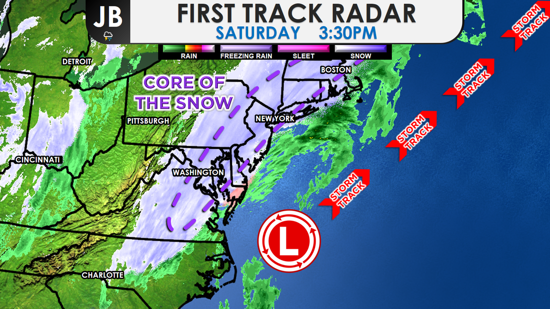
 Current regional storm overview. The snowflakes have been wet and fat at times, when it hasn't been raining. Many area roads are just wet this afternoon, as ground temperatures have been above freezing. Air temperatures in the mid 30s have lead to snow mainly just sticking to the grass when it's falling hard enough. Suburban locations to the south and east, like Lusby and Ridge, were coming up on and surpassing 3-4 inches of accumulation as of early-to-mid afternoon. Meanwhile most spots closer to the Beltway, in the the District, and northwest suburbs of town were in the 1-2" range. Our accumulation map from earlier seems to be mostly on track, except that many look to be on the lower end of accumulation totals. Since last night, the National Weather Service has downgraded many in Southern MD from the Winter Storm Warning, which actually still remains for St. Mary's, to a Winter Weather Advisory. However, all advisories and warnings have been extended until 9pm tonight, as the snow seems to last longer than initially thought. 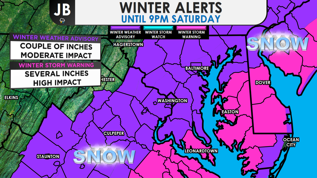 After last night's initial burst of snow across far southern and eastern areas, there a 5-6 hour lull in the activity this morning. The snow didn't start to get going until mid-morning and there have been a few dry slots, and areas of mixing across the region. Both of these have lead to lower totals than some assumed. I never really bit on to the idea of major, substantial snow totals. The final call from yesterday had many in a 2-5"+ range, but I did acknowledge the very many caveats to this forecast. Some outlets were forecasting 6-8"+ totals, which always seems a bit overzealous to me. Another inch or so is possible before the snow tapers off around 6-8 p.m. Please drive carefully as wet roads can quickly turn slushy and slippery during heavier bursts of precipitation. Lead Forecaster
-John Bordash
0 Comments
Leave a Reply. |
Archives
August 2020
Categories
All
|
 RSS Feed
