
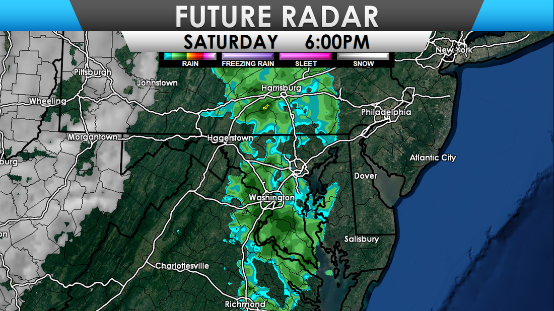
 A strong cold front will move across the Mid-Atlantic Saturday evening, bringing gusty northeast winds and cooler temperatures. Lows tonight get between 28 and 34 for most, with 10s and 20s for the mountains. A few showers will move through the region, with the cold front, this evening. Areas west of I-81 can expect showers between 1-3pm, between 3-5pm for areas between I-81 and I-95, and after 5pm for areas east of I-95. Ahead of the front, temperatures get between 63-70 degrees for most of the region. After the front moves through, temperatures will quickly fall off. Shown below are the expected temperatures at 8pm. 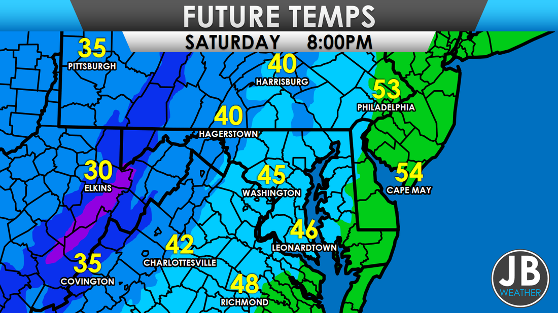 Additionally, behind the front, snow showers are expected in the mountains, and higher elevations. Winter Weather Advisories are in effect for these locations. I am not expecting any snow for any locations not in, or near, the mountains of MD, WV, and PA. Below is my snowfall forecast map. 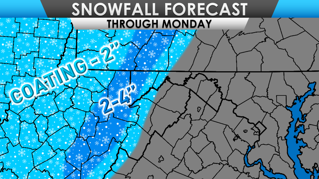 As mentioned before, strong winds will also move into the area, tonight through Sunday. A Wind Advisory is in effect for a large portion of the Mid-Atlantic. Winds could be sustained between 20 and 30mph with gusts up to 50mph. Strong winds may blow down limbs, trees, and some power lines. 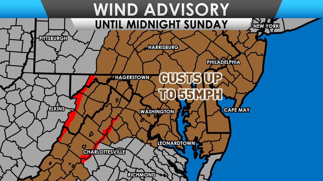
0 Comments
Leave a Reply. |
Archives
August 2020
Categories
All
|
 RSS Feed
