
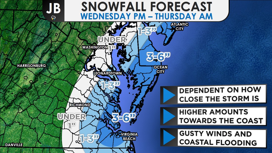
 First Call on Snowfall Next Chance of Accumulating Snow: Wednesday PM - Thursday Probability of Accumulating Snow (1" or more): 60% Most model guidance which has come in since last night continues to show a high likelihood of snow Wednesday night into Thursday. As I've been discussing for several days now, this forecast has been extremely difficult. Unfortunately, the normally added benefit of nearing closer to the onset of the storm isn't helping a lot. Why is the forecast so uncertain? It's because the storm is basically forecast to develop explosively very close to us and any minor shift in the timing or placement of this development has major implications for the snowfall amounts. If the development occurs later and slightly further east, we could get very little. Or if it happens earlier and a hair further west, we see a more significant event. Further east northeast, from the Delmarva peninsula to Boston, the uncertainty is reduced because those locations are sure to be closer to the storm center which will have had more time to develop, especially as you head north. 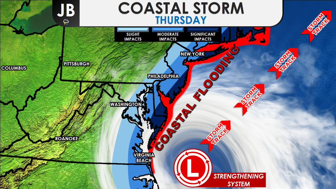 As shown, the most significant impacts will be felt closer to the coast, and up in New England. If this storm were to track just a smudge more westward, more moderate impacts would shift into Southern Maryland. Snow likely starts to move into Southern MD after sunset around midnight, Wednesday night. As the storm starts to strengthen, snow will continue for areas east of I-95 throughout early to mid morning. Moderate to heavy snow falls on the Delmarva during this time. Winds will also be rather gusty right along the Atlantic shoreline. This gusty, onshore winds increase the risk for coastal flooding. The storm will begin to move away, and snow will shut off by lunchtime.
All-in-all, this does not appear to be a major snowstorm for Southern MD. However, a slight shift westward could spell a different story. Right now, prepare for light, accumulating snow to impact the area Thursday morning. Some travel and school delays are possible, but that will come into better focus tomorrow. Impacts look to be minimal, but whatever falls will stick thanks to our recent cold blast. This has been, and continues to be, a changing forecast. The minor details, surrounding the track of the storm, should come into better focus tomorrow. Lead Forecaster -John Bordash
1 Comment
Crowley
1/3/2018 08:12:32 am
I hope you are right about snow coming! Leave a Reply. |
Archives
August 2020
Categories
All
|
 RSS Feed
