
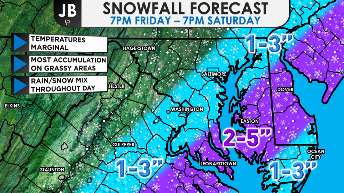
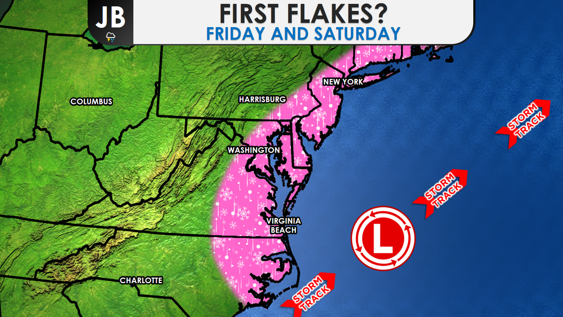
Next Chance of Accumulating Snow: Friday - Saturday Probability of Accumulating Snow (1" or more): 60% Our first snow event of the season is on track to arrive tonight. The big question is how much snow and how big of an impact. Highs today will reach into the 40s, and ground temperatures are relatively warm, but temperatures are on their way down with chances of some accumulating snow tomorrow on the rise Light precipitation should begin during the evening. It should be in the form of rain in many spots, though a rain/snow mix is not out of the question. Temperatures will be in the mid-to-upper 30s and falling. Precipitation will spread over the area during the morning on Saturday and should stay mainly snow for areas west of the Bay, as temperatures fall to near freezing. Some accumulation is likely, especially during the morning on Saturday. Snow will mainly stick to just grassy, and untreated, areas. Snow should begin winding down around 5-8 p.m.
Another question/concern that I have are the temperatures. Throughout the majority of this event, temperatures will be in the middle 30s. That means that snow will have a hard time sticking initially. However, if the snow can fall fast enough, in heavier bands, the snow would be able to accumulate (which is what looks like will happen). Dry slots are also a concern with this storm, and where they would set up. Snow may mix with sleet and rain at times, especially along coastal areas, cutting down totals. With all this all in mind, I have to say-- this is a low confidence forecast. It's not often I say this, but, it's not a guarntee that my forecast will verify for everyone. The small micro-climates and variable conditions make this a difficult forecast. It is very possible that some see more than forecasted, and equally as possible that some see less than forecasted. Nevertheless, I think this forecast is good general baseline.
Lead Forecaster -John Bordash
0 Comments
|
Archives
August 2020
Categories
All
|
 RSS Feed
