
 The eleventh Tropical Depression (TD) of the 2015 Tropical Season has formed. Moisture from T.D. 11 and a slow moving storm system may join together to give the Northeast and Mid-Atlantic quite the soaking this weekend. Firstly, lets talk about what's going on with TD 11. If you're looking for quick information on this storm, scroll down to the "Conclusion". Tropical Depression 11 Info As of the 5pm Advisory from the the National Hurricane Center, our tropical depression currently sets about 630 miles northeast of Miami, FL, and isn't moving all that fast (only six miles an hour). The above image shows the storm's current stats with its project path in gray. Right now, we're not expecting this storm to get all that strong, but will likely strengthen enough to reach tropical storm status (look at graphic below for tropical system strength scale). If the storm were to achieve tropical storm status, it would be given the name "Joaquin". 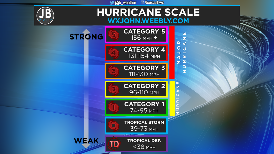 In the United States, we use the Saffir Simpson Hurricane Scale (aka the Hurricane Scale) to measure tropical cyclone intensity. Tropical Depressions are the weakest rating and Category 5 being the strongest. Weekend Forecast Discussion Steering winds in the upper atmosphere could lead to a system moving north from the Gulf of Mexico (non-tropical at the moment), Tropical Depression 11, as well as few other weather stems to come together along the East Coast by this weekend. High pressure to the north will play a big role in how things shape up. Now, how nasty conditions get along the East Coast, and in Southern Maryland, are completely dependent on Tropical Depression 11's strength and track. If TD 11 tracks further the west, we would see nastier conditions, however, if TD 11 track further east, conditions would not be as bad. At the moment, it appears that the heaviest rains, and worse conditions, should be in Southern New England. Many of our weather models keep the storm as a weak Tropical Storm, heading up the coast into New England/out to sea all together. However, a few keep the system close to the coastline, and even have it making landfall along the New Jersey or Long Island coastline, which would mean more impact here. Right now, I'm leaning slightly more towards a track that is more out to sea, and thus, not as devastating to the weekend forecast. Regardless, it looks like the most troublesome time period will be from Saturday morning into early Sunday morning, with Sunday looking at least halfway decent. Here are the two scenarios:
Conclusion
The forecast with TD 11 is not the easiest, especially five days out. This forecast is 100% reliant on the storm's track and strength. Right now, expect some showers Saturday, with some gusty winds near 20mph on Saturday, however, Saturday will not be a washout. Sunday looks to offer some clearing. Stay with JB Weather for the latest on Tropical Depression 11, and it's possible impacts on SoMD Lead Forecaster -John Bordash
0 Comments
Leave a Reply. |
Archives
August 2020
Categories
All
|
 RSS Feed
